The Man Who Made the Modern World

There wasn’t much about the boy to suggest that he would be the father to the 20th century. Thomas Alva Edison was the seventh child of his parents and the fourth to survive to adulthood. He developed hearing problems when young and, while not totally deaf as an adult, he was very hard of hearing. He wrote, “I have not heard a bird sing since I was 12 years old.” Given his many inventions, it’s surprising that Edison never invented a hearing aid, although he often said he was working on one. But growing up deaf, he realised, had helped him, allowing greater concentration on his work and tuning out the “babble of ordinary conversation”.

Born on 11 Februay 1847 in Milan, Ohio, the young Edison had little schooling and what he had provided little of worth: he learned by reading – he was a lifelong, voracious and omnivorous reader – and doing. One of Edison’s first jobs was selling sweets and newspapers to railway passengers. During his breaks, the young Edison did chemistry experiments in the baggage car.

Telegraphy was the communication breakthrough that, together with the railroad, was opening up the vast expanses of the United States. In 1863, at the age of 16, Edison became an apprentice telegrapher and, naturally for him, started experimenting on improvements and by January 1869 he had done enough to believe that his future lay in being a full-time inventor.

That future lay in New York, which was where Edison moved, working initially on improvements to telegraphy so that it was possible to send four signals down one wire at once. Edison’s work on the quadriplex, as this new system of telegraphy was called, was snapped up for $100,000. There was serious money in these new-fangled inventions.

Unfortunately, Edison’s talents did not stretch to money management, and neither did those of his young bride, 16-year-old Mary Stilwell, so the couple moved away from the financial temptations of the city to Menlo Park, New Jersey, which was then a quiet rural backwater. At Menlo Park Edison built the world’s first research and development laboratory, combining a lab and machine shop.

It was here that Edison earned the soubriquet, ‘The wizard of Menlo Park’, creating many of the inventions that would usher in the modern, technological world. But these were not just the result of Edison: one of his unsung but crucial talents was his ability to bring together and motivate a team of skilled designers, technicians and engineers. In part this was because every member of the team was positively encouraged to note down ideas and bring them to the rest of the team. Good ideas were pursued by all. Edison’s working methods were unlike those that typified most scientific research. Rather than investigating experimentally the predictions of a theory, Edison pursued hunches, interests, anything that caught his fancy, treating every setback as a new avenue towards greater understanding. When some expensive chemicals were left out in sunlight and degraded, rather than bemoan the loss, Edison stopped all his other experiments and had his team investigate the properties of the degraded chemicals. Everything was interesting and, sometimes, useful. As Edison said, “Genius is hard work, stick-to-it-iveness, and common sense.” But the combination of gifts Edison brought together was far from common.

Edison’s research at Menlo Park produced the carbon microphone that made telephones a world wide technology, the basic design continuing in use for the next century; devised a system of electricity distribution that allowed the first widespread use of electric lights; devised the first cinema camera, known as the ‘Kinetograph’; and invented the electric light bulb. The neon-lit, connected, fame-obsessed world of the 21st century has its origin in Edison’s inventions in the second half of the 19th century.

On 9 August 1884, Edison’s wife, Mary, died. She was 29. The couple had three children. Edison remarried two years later, his new bride being 20-year-old Mina Miller. Edison was now 39. He had three more children with his new wife, moving with her to a new home and research complex in West Orange, New Jersey. The new facility saw the development of alkaline batteries, the foundation of the cinema industry and the production of commercial phonographs but, being larger and less intimate, it was not as conducive to the sort of small-team work that was the foundation for Edison’s most remarkable inventions. However Edison, ever the workaholic, continued working there until his 80s.

Thomas Edison died on 18 October 1931 at his home. The world around him was a very different place to that into which he had been born and probably no single man had changed it more than he had.

Brothers In the Sky

Wilbur (left) and Orville Wright.

The date is famous. 17 December 1903. On that Thursday the Wright brothers, Orville then Wilbur, made the first controlled powered flights in a heavier-than-air machine. In all, there were four flights that day, two for each brother. Five people watched history being made. Reports reached the press. And then…nothing happened. Barely any newspapers covered the story and the news faded away. No one could believe a couple of bicycle makers from Dayton, Ohio, a place as far from the beating heart of things then as it is today, had done what other better known, better educated and better connected people had failed to do. But it was precisely the roots the Wright brothers had in Dayton that made possible their extraordinary achievements. Of these roots, none were more important than their parents.

The Wright family home in Dayton, Ohio.

Milton Wright, father to the clan, was minister then bishop of the Church of the United Brethren in Christ. He fostered in his sons a love of reading and free intellectual inquiry that stemmed from his own interest in debate; if the boys, growing up, were engaged in some important investigation he happily turned a blind eye on them skipping school to concentrate on whatever new device they were constructing. However, it was from their mother, Susan, that the boys inherited their engineering flair: she constructed her own household appliances and made toys for the boys. Susan had met Milton during her studies at the United Brethren college in Hartsville, where she was studying English literature. Thus Wilbur and Orville grew up in a household predicated upon a deep commitment to learning, unshakeable faith (which the brothers also transferred into confidence in their work) and adherence to principles.

Milton and Susan had other children too: twins who died in infancy, two other sons, older than the flying brothers who made lives of their own, and the youngest, Katharine, who would share house, conversation and duties for many years with her famous brothers.

Wilbur Wright, born 16 April 1867, was the elder. In photographs of the pair he is the intense, balding figure with penetrating eyes. Orville Wright, born four years later on 19 August 1871, looks generally more avuncular and wears the thick moustache typical of the era. Despite the difference in age, the pair were inseparable. But separation was in the offing as Wilbur neared graduation from high school. A brilliant student – his test scores were in the 90s for everything – and an outstanding athlete, Wilbur was destined to fly high, educationally speaking: he was set for Yale.

Then, it happened, and everything changed. During an ice hockey match, a hockey stick smashed into Wilbur’s face, knocking out most of his upper front teeth. Wilbur suffered months of pain, followed by bouts of depression and withdrawal. Yale was out of the question. What’s more, their mother, Katharine, was ill with tuberculosis. Wilbur became her carer and, having retreated to the confines of the house, he read and read and read.

Wilbur Wright working in their bicycle workshop in 1897.

For his part, Orville had become fascinated with printing and, while still at school, built his own printing press using a tombstone, a spring from a horse buggy and scrap metal. Milton Wright credited the care Wilbur took of his mother for extending her life far beyond what was thought possible with tuberculosis, but in 1889 Susan Wright died. Wilbur, slowly emerging from his isolation, joined Orville in his printing business. In response to the national bicycle craze, in December 1892 the brothers started repairing bicycles and by 1896 they were building them too. They were assembling the skills they would need for the task that increasingly preoccupied them: flight.

One of the gliders the brothers built to test the principles of flight.

The boys first memory of flight was when their father brought home a toy helicopter, a contraption of wood and rubber bands, that they flew until it broke. But it was the news of the death, in August 1896, of Otto Lilienthal, the pioneer of glider flight, that resparked their interest in flight. In response, Wilbur did what he always did first: he read. Everything. When Orville recovered from a bout of typhoid, he joined his brother in scouring the libraries of Dayton. When these were exhausted, they wrote to the Smithsonian Institution asking for further reading – at the time, the Smithsonian was itself sponsoring expensive research into powered flight.

Wilbur Wright in one of their gliders as it lands leaving skid marks in the sand.

The Wright brothers were by no means the only people investigating flight: there were many inventors and teams working on how to fly. But what would set the brothers apart was the methodical way they broke down the problem and, in doing so, identified the key difficulty before flight could be achieved. The Wright brothers reasoned that there were three requirements for successful flight: a means of generating lift, some way of propelling the craft through the air and a system to direct and control the craft. All the other researchers were looking mainly at the first and second parts of the problem. The Wright brothers realised that it was the third part, the control system, that was least understood and most critical. After all, Otto Lilienthal, with his work on gliders, had demonstrated how wings could produce lift, and the burgeoning automobile industry was developing new, lighter and more powerful engines all the time. The real difficulty was control. This was where the brothers’ experience as cyclists was crucial. A cyclist, turning a corner, leans into the corner. They realised that the most effective way to turn a plane was for it to do the same, that it should bank in the direction it was turning (other researchers envisaged a system like a car, where the vehicle remains level while changing direction).

The first powered flight, piloted by Orville Wright.

Starting with self-made gliders, the Wrights tested out their ideas for controlling a craft in flight, developing the system of three-axis control – roll (lateral motion), pitch (up and down) and yaw (side to side) – that underlies aircraft control systems to this day. Through three years testing at Kitty Hawk on the Atlantic Coast of America – a site chosen for its isolation, helpful winds and soft sand to cushion hard landings – the Wrights brought their craft towards the ideal of powered flight. In December 1903, they were ready. The first attempt, on 14 December, damaged the plane. But at 10:35 on 17 December 1903, Orville Wright took off, flying 120 feet (36m) and staying in the air for 12 seconds. Wilbur had the second go, going further, then Orville outdid him only for Wilbur’s final flight (852 feet in 59 seconds) to eclipse all three previous efforts. They had done it.

Orville flying the Wright Type A Airplane at Ft. Myer, Va. on Sept. 9, 1908

The press completely missed the story. The Dayton newspaper said the flights were so short the news wasn’t worth printing. Never men to court publicity, the Wrights weren’t too bothered. Besides, they wanted to perfect their airplane and they spent the next couple of years doing so. European aviators were sceptical of the rumours they were hearing about the Wright’s plane. All that would change in 1908, when Wilbur Wright began making public demonstration flights in France. All that they had heard about the Wright’s flyer was true – and more. Meanwhile, in America, Orville was demonstrating their plane to the US Army. The brothers, having funded their research out of their own pockets, needed to make money of their momentous invention.

In Europe, the control and distances over which Wilbur piloted his plane caused a sensation.

The demonstration flights put an end to all doubts. The Wrights took off, flew circles and figure-8s, and landed, all while in total control of their planes. The two brothers from Dayton, Ohio, had done it. They had realised mankind’s second oldest dream. We could fly.

The First Man on the Moon

They were 6,000 feet (1,800m) above the Moon’s surface when the alarms started going off. The Lunar Module Eagle was descending far to the west of its designated landing site. Then, looking out of the window, Flight Commander Neil Armstrong saw that the Eagle’s computer system was aiming to land them on the steep slope of a crater made jagged with boulders. The mission to land a man on the moon and return him safely to earth, always a tall order, was beginning to look more and more like it was going to fail.

But that was when Armstrong took control of the Lunar Module. Over his career as a fighter pilot, test pilot and astronaut, Armstrong had been shot down, had the engine of his plane explode and ejected from a Lunar Module simulator seconds before it crashed. He’d survived all these close escapes with nothing more than a bitten tongue and a reputation for never panicking under pressure. Now, Armstrong did what he always did: he stayed calm and played the situation as he saw it. In control of the lander, Armstrong and his co-pilot, Buzz Aldrin, scanned the lunar surface for somewhere safe to land, while the Eagle hovered 500 feet over the lunar surface, riding its rockets. Armstrong moved the craft sideways, searching for somewhere clear to land. They’d been hovering now for 90 seconds. Back on Earth, the mission controllers, watching the fuel supply gauges, were getting worried. Seriously worried. The Eagle had less than a minute of fuel left.

Then they saw it: an area clear enough to land. The Lunar Module descended. 400 feet. 300. 200. 100. 50. 20. Then, one of the probes that dangled down below the landing pads of the Lunar Module touched not earth but Moon. Seeing the warning light on the control panel, Aldrin said, “Contact light.”

“Shutdown,” said Armstrong, cutting the rockets. “OK. Engine stop,” said Aldrin.

The Eagle settled down upon the surface of the Moon, its landing soft under the gentle gravity, only one sixth that of Earth.

Armstrong and Aldrin looked through the windows and saw the dust blown up by their rockets spreading away from them. Outside was the Moon.

Armstrong got on the radio. “Houston, Tranquility Base here. The Eagle has landed.” It was 20:17 UTC on 20 July 1969. On 17 December 1903, the Wright brothers had made the first powered flight, travelling 120 feet during that first flight. Now, 65 years later, two men had travelled 240,000 miles through space and were about to set foot on the Moon.

Growing up in Ohio in the 1930s, Armstrong (born 5 August 1930) certainly didn’t expect to find himself looking over the colour leached surface of the Moon a few weeks shy of his 40th birthday. But from his earliest childhood, Armstrong had been fascinated by flight. His father took him to an air show when he was two and for his first flight when he was five. Living in Wapakoneta, Ohio (population just over 5,000), the young Armstrong took a job with a local chemist so that he could pay for flying lessons. Already proficient as a flyer, Armstrong received his official flying license on his 16th birthday, meaning that he could fly before he could drive.

Having graduated from high school, Armstrong went to Purdue University where he studied aeronautical engineering as a naval air cadet. Two years later, on 26 January 1949, Armstrong was called up into the Navy and, after flight training, served as a pilot in the Korean War, flying 78 combat missions in Gruman F9F Panthers from the aircraft carrier USS Essex. On one low-level bombing mission, having been hit by anti-aircraft fire and struggling to regain control, the wing of Armstrong’s jet hit a cable – he was only 20 feet off the ground at the time – cutting six feet off the end of the plane’s right wing. Armstrong managed to nurse his plane back into friendly airspace and then ejected. Armstrong’s combat tour lasted from August 1951 to May 1952; 27 of Armstrong’s fellow pilots on the Essex were killed during these missions.

His war over, Armstrong returned to Purdue to finish his studies, receiving a BSc in aeronautical engineering in January 1955. With skills in engineering to match those in flying, Armstrong was accepted when he applied to become a test pilot with the National Advisory Committee for Aeronautics (NACA) just before it was renamed the National Aeronautics and Space Administration (NASA).

As a test pilot, Armstrong flew many of the X planes, the jet- and rocket-powered craft that were pushing airplane technology further, higher and faster. Some of these planes had to be launched from the air and it was while carrying an X plane up to its launch altitude aboard a B-29 Superfortress that Armstrong had another fly past with disaster: one of the plane’s engines exploded, knocking two others out of action, and cutting the co-pilot’s control cables. Armstrong, with one engine working, managed to glide the B-29 back down to a safe landing.

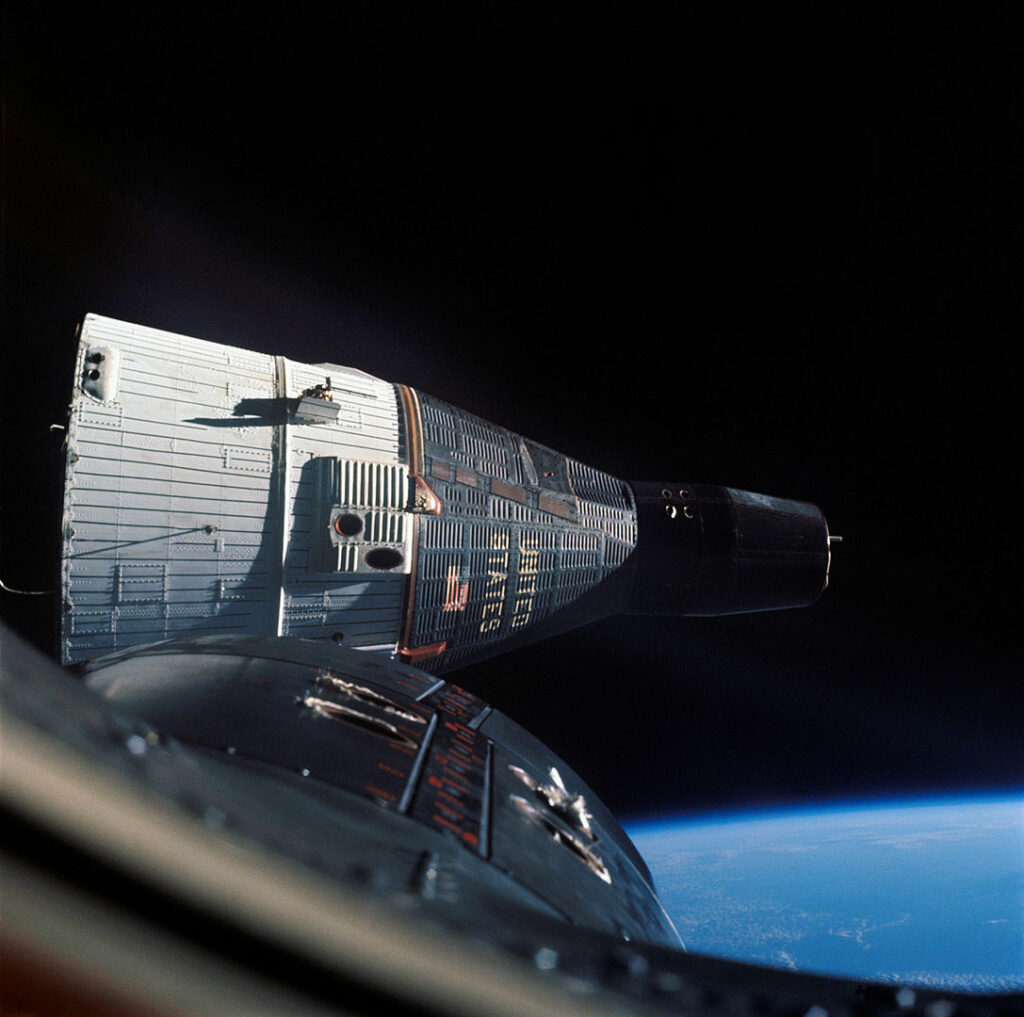
Apart from his many other test flights, Armstrong flew the X-15 rocket plane seven times, touching space and reaching speeds of 4,000mph. He was, in all but name, an astronaut. That title would follow when, in September 1962, Armstrong was selected as one of the second group of astronauts for the NASA space programme. As part of the space programme, Armstrong took part in testing and development, areas where his combination of engineering and flight skills were particularly valuable. On 16 March 1966, Armstrong sat, with Dave Scott, atop the Gemini 8 rocket as it quivered under the 430,000 pound thrust of its engine before firing up, up, up into space. The huge engine generated 6G of thrust but at the end of it, Armstrong and Scott were in orbit. There, they made the first docking in space between their command module and an unmanned target vehicle before a safe re-entry into Earth’s atmosphere.

All was set. On 16 July 1969, Apollo 11 with Armstrong, Aldrin and Michael Collins aboard blasted off from Kennedy Space Centre. On 19 July, the mission reached the Moon, swinging into orbit. A day later, Armstrong and Aldrin entered the Lunar Module, leaving Collins in the Command Module to orbit the Moon alone, and began their descent.

Safely down, NASA’s schedule called for the two astronauts to take a five-hour sleep before leaving the lander as they’d been awake for a long time. Not entirely surprisingly, Armstrong and Aldrin found going to sleep – they were on the Moon! – impossible, and asked for permission to bring forward their EVA (extravehicular activity). Permission granted, the astronauts suited up and depressurised the Eagle. At 02:39 Armstrong opened the hatch and at 02:51 began to climb down the ladder on the outside of the lander. There were nine rungs on the ladder. At 02:56 UTC on 21 July 1969, Armstrong stepped off the footpad and stepped on to the Moon.

“That’s one small step for [a] man, one giant leap for mankind.”

Twenty minutes later, Aldrin joined Armstrong. The two astronauts spent 2 hours, 31 minutes walking on the Moon, collecting samples and setting up experiments. The Earth hung, blue and white, in the black sky. Then they returned to the Lunar Module and settled down to rest. At 17:54 UTC, they ignited the rocket in the Eagle’s ascent stage and took off. Armstrong and Aldrin had been on the Moon for less than a day.

After returning to Earth, Neil Armstrong gave up space flight and left NASA in 1971, taking up a post in the Department of Aerospace Engineering at the University of Cincinnati. He lived a quiet life, generally shunning publicity, and flying gliders from his farm near Lebanon, Ohio. On 25 August 2012, Neil Armstrong died from complications following heart surgery. He was 82.

Between 21 July 1969 and 19 December 1972, twelve men walked on the Moon. No one has done so since.

The Space Race

John Glen, the first American to reach earth orbit, aboard his Mercury rocket in 1962.

On 4 October 1957, the Soviet Union stunned the world, and in particular the United States, by launching Sputnik 1 into orbit. Then, on 12 April 1961, the Soviet Union sent Yuri Gagarin into space and brought him safely back to earth. The space race had begun and the Soviet Union had a clear lead.

In a time when the world was locked into a confrontation between the communist Soviet bloc and the West, the propaganda advantage in leading the race into space was immense.

In response, on 25 May 1961 President John F. Kennedy asked Congress to commit the nation to, “before this decade is out, […] landing a man on the Moon and returning him safely to the Earth”. Following Kennedy’s assassination, this pledge became sacrosanct.

To catch up with the Soviet lead, the Americans planned a series of manned spacecraft, beginning with the Mercury rockets crewed by a single astronaut, going on to the two-man Gemini missions that pioneered many of the technologies and techniques necessary for a flight to the Moon, and culminating with the three-man Apollo programme designed to take men to the Moon.

Despite the Apollo 1 disaster, when three astronauts were killed in the Command Module during testing on the launch pad when a fire broke out, by the late 1960s the American space programme had overtaken the Soviets. Now all that remained was to fulfil Kennedy’s pledge.

A Leftie in a Right-Handed World

Jimi Hendrix playing his upside down, turned round guitar.

Jimi Hendrix, famously, played guitar left handed – that is he fretted notes with his right hand and strummed the strings with his left hand. But left-handed guitars were few and expensive, so Hendrix took an ordinary right-handed Fender Stratocaster, flipped it upside down, so that the tuning pegs were on the bottom, and restrung it.

Doing this changed how the guitar sounded. A Fender Stratocaster has three pickups (electric microphones that produce the signal fed to the guitar’s amplifier), with the rear pickup set at an angle to the strings. Reversing the guitar meant that this pickup took its signal from the higher strings further up the fretboard, producing a sweeter tone. By reversing the guitar, Hendrix also changed the relative distance of each string from its pickup, thereby altering the mix of sound in the guitar’s signal to the amp.

Another effect of reversing the stringing on his guitar was the highest strings, which on a normal Stratocaster are the longest, became the shortest on the Stratocasters Hendrix played. A shorter string requires less tension to tune it, making the string easier to bend and thus easier to play. This change also altered the amount of string between the nut at the end of the fretboard and the tuning peg. Although the nut prevents this length of string actually playing, it produces overtones when the string is plucked. Changing the length of these parts of the strings also contributed to the unique Hendrix sound.

The Battle of Heavenfield AD 634

The combatants

Oswald (603/4 – 642), exiled prince of Northumbria

Forced into exile as a 12-year-old boy when his uncle, Edwin, killed his father, Æthelfrith, and took the kingdom of Northumbria, Oswald grew to manhood in the kingdom of Dál Riata. While there, Oswald and his exiled family, previously pagan, embraced Christianity with varying degrees of fervour, and Oswald himself gained a reputation for martial valour and Christian piety. When Uncle Edwin was killed by Cadwallon, King of Gwynedd, Oswald remained in Dál Riata, only launching his own effort to retake the throne after Cadwallon had killed two other pretenders, both relatives of Oswald. Victorious at the Battle of Heavenfield, Oswald brought monks from Iona to preach the new religion to the Northumbrians, in the process creating institutions that were able to survive Oswald’s own death in battle in 642. A cult rapidly developed around Oswald following his death, with the martyred king – he died in battle against the pagan king of the Mercians – becoming a popular saint in Britain and Germany.

Cadwallon ap Cadfan (d.634), King of Gwynedd

Cadwallon was the subject of vituperation in Bede’s Ecclesiastical History of the English People, the villain around whom the first half of the book is structured. In Bede’s account, he was a violent marauder, bent on exterminating the Northumbrian people. But for the Britons, Cadwallon was their last great champion, ‘the fierce affliction of his foes, a lion prosperous over the Saxons’. On the Isle of Anglesey, the breadbasket of the Kingdom of Gwynedd, the kings had their palace at Aberffraw. There, Cadwallon raised a memorial stone, visible today inset into the wall of the Church of St Cadwaladr. CATAMANUS REX SAPIENTISIMUS OPINATISIMUS OMNIUM REGUM. ‘King Catamanus, wisest, most renowned of kings.’ Catamanus is the Latin form of Cadfan, Cadwallon’s father. The brutal warleader of Bede’s account raised a Latin inscription praising the wisdom of his father. History, as written by different sides.

The Battle

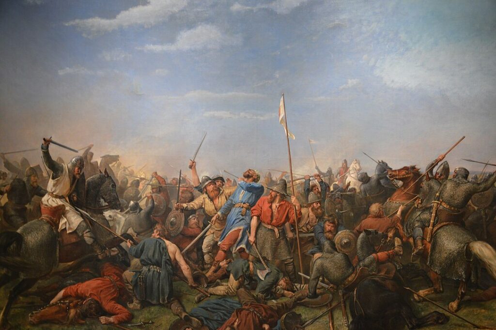
It was a bleak place to die. The moors rose steeply from the east bank of the Devil’s Water, their flanks bare of cover. The river itself, that had provided the remnants of the retreating army with some cover at the start of the long rout, now boxed them in. Coming to another stream, Denis Brook, that fed the Devil’s Water the leader of the retreating men signalled those still left with him to turn and make a stand. The moors rose up to the south. There was no escape that way, not with their pursuers following so close behind. The only chance was to buy a little time, to bloody the hunters so that they had to stop and regroup, and then attempt to escape.

Cadwallon, King of Gwynedd, the most successful warlord in Britain, the killer of kings and the hope of his people, ranged his retainers beside him, anchoring the flank against the river. There were so few of them now that he could do nothing to protect the right wing of his shield wall. They waited. They did not have to wait long.

The man leading the pursuers had been given a nickname, Lamnguin, by the people with whom his mother had sought safety when he was still a boy. Lamnguin meant ‘white blade’. But it was not white now. The man’s name was Oswald.

With the Denis Brook at his back, Cadwallon prepared to make his stand. The moors, bare of trees in the 7th century as they are bare today, looked down with the detachment of geology. Humans many generations earlier, during the Neolithic, had stripped the hills of their tree cover, their stone axes proving as adept at deforestation as later tools of iron and steel.

The final battle was brief but brutal. At its end, Cadwallon and the men of his household lay dead, their bodies stripped of ornaments and armaments.

The Battle of Heavenfield was over. Oswald, Northumbrian ætheling in exile, had returned to reclaim his crown. Ætheling is an Old English word meaning a man who is throne worthy. Among the Anglo-Saxon kingdoms that had been established in the east and central regions of Britain there was no settled system for the transmission of power – how could there be, when power was something that was taken, and kept, with the sword.

The Background to the Battle

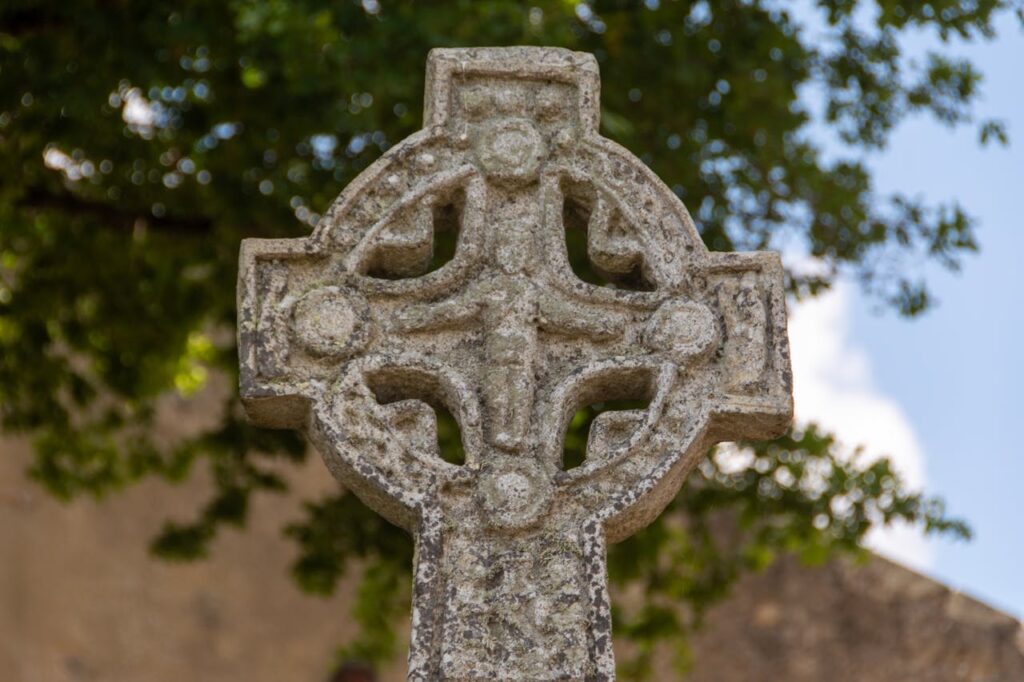
The cross at Heavenfield

To be a king of one of these kingdoms did normally require some connection to the ruling family but just as important for the succession was the ability of a claimant to the throne to gain the support of the leading men of the kingdom. If all else failed, power could simply be grabbed, taken in battle and then cemented by further warfare. If this makes early-medieval Britain sound like a chaotic place of incessant warfare, that is pretty much what it was like. This was a time when a warband of 50 men might win a kingdom. A later law code, promulgated by King Ine of Wessex in 694, defines an army (here) as a group of 35 or more men.

St Oswald’s Church, Heavenfield

So it is likely that, as Bede says in his account of the Battle of Heavenfield, Oswald was leading a small band of men when he confronted Cadwallon. The name of the battle is misleading, for it commemorates the place where Oswald camped on the eve of the battle. There is a church at Heavenfield today, a largely Victorian rebuilding of an earlier Norman church that was itself built over an early Medieval building. The church is named, naturally, St Oswald, for the warrior king was acclaimed a saint following his death in 642. Of course, the church postdates Oswald’s camp. Bede informs us that Oswald camped on the northern side of Hadrian’s Wall and that monks from Hexham had later raised a church on the site.

The maximum extent of the kingdom of Dál Riata

Oswald’s small warband was relying on the tactics of surprise and assault that Oswald had learned during his years spent with the kings of Dál Riata. In that kingdom, which stretched from Northern Island to Argyll, the obligations of the three clans of the kingdom were assessed in the numbers of boats and warriors each clan had to provide to the king when called to the kingdom’s defence. The Dál Riatans pursued the tactics of surprise and sea-borne assault that would serve the Vikings so well three centuries later – and Oswald had learned these tactics during his formative years, when he had earned his nickname fighting with the king’s warband.

Stanegate in Corbridge

While Oswald could not arrive by sea, his aim was to attack Cadwallon before news of his presence could reach the King of Gwynedd. Oswald and his men had outridden rumour, most likely galloping along the Stanegate, the west-east Roman military road that ran just south of the Wall and predated it. Near St Oswald’s Church, that commemorates Hefenfelth, the ‘heavenly field’ where Oswald and his men camped, archaeologists discovered the remains of what is prosaically called Turret 25B, one of the milecastles of Hadrian’s Wall. Nothing remains above ground, but it would have made a good night camp for Oswald and his men, providing shelter and, since it lay on the declining slope of a ridge, cover from eyes looking from the direction of Cadwallon’s camp.

St Columba preaching to the Picts

It must have been a tense night. During the course of it, according to the account written by Adomnán, abbot of Iona from 679 to 704, Oswald had a dream vision of St Columba, the founder of the monastery on Iona and the man whose spiritual legacy lay over the Irish Sea and its surrounding lands. In the vision, the saint promised Oswald victory on the morrow. For Oswald, who had gone into exile as the pagan son of pagan Anglians, had become enchanted by the new faith of the Holy Isle during his growing up, and embraced it wholeheartedly. In Bede’s account Oswald also raised a cross before his warband, holding it in place while his men made it firm, then kneeling with his men to ask God’s blessing for their cause.

Iona Abbey in the 19th century

This was an age when men judged heaven’s favour by the most fundamental of metrics: those who won and those who died in battle. The monks of Iona, from whom Oswald had received the new faith, had seen in their young protégé a man who could do something no one else had been able to do: bring the faith to his pagan brethren. Yes, Augustine, the Italian emissary of Pope Gregory the Great, had landed in Kent in 597, but after its initial success the Augustinian mission had stalled. The sponsorship it had enjoyed through the patronage of Æthelberht, King of Kent, the most powerful king among the Anglo-Saxon kingdoms of Britain, had died with Æthelberht.

There had been northern success when Edwin, King of Northumbria, Oswald’s uncle and the man who had killed Oswald’s father, converted to Christianity. But then Edwin fell in battle to Cadwallon the nascent Christian kingdom Edwin was trying to set up collapsed too. This was very much the pattern of early-medieval Britain. A warlord would rise, winning power and prestige through success in battle, and thereby attracting glory hungry young men to his warband. The warlord would expand his power, forcing other kings to pay him tribute, with regular skirmish wars to exact further treasure, until a battle too far ended in his utter defeat and death, with the consequent dissolution of whatever rudimentary kingdom the king had built up. Edwin’s kingdom dissolved on his death.

But after defeating Edwin, Cadwallon, unusually, did not return to Gwynedd. Instead he remained far from home in Northumbria, killing two further claimants to the Northumbrian throne, Edwin’s cousin Osric and Oswald’s half brother, Eanfrith.

Bede’s portrays Cadwallon as a rapacious predator, bent on destroying the Anglian kingdom of Northumbria and its people. His portrait is one-sided: for the Britons, the native people of Britain, Cadwallon was a champion, their ‘furious stag’ who broke from the mountain strongholds to which they had withdrawn to reclaim their inheritance. As such, Cadwallon’s long stay in Northumbria, which had become the pre-eminent Anglo-Saxon kingdom under the rule of King Edwin, makes some sense. Cadwallon, like most of the Britons, was a Christian, a man who was still sufficiently versed in Romanitas to have a Latin epitaph carved on his father’s gravestone. But the monks of Iona, the most important spiritual centre in the Irish Sea, decided to favour their own man, Oswald, in the struggle for the throne of Northumbria. The descendants of Cadwallon, the Welsh, included in the Mabinogion their lament for their fallen champion and a veiled reference to the treachery of Iona.

From the plotting of strangers and iniquitous
Monks, as the water flows from the fountain,
Sad and heavy will be the day for Cadwallon.

Cadwallon’s army had been on campaign for a more than a year. The initial warband, the warband that had defeated and killed kings and made Cadwallon the most successful warlord in Britain, had bloated and swelled with hangers on and the loot of many victories. Camping somewhere near Corbridge, at the junction of Dere Street and Stanegate, Cadwallon could guard the bridge over the River Tyne. But Oswald had advanced faster than the news of his landing in Britain could reach Cadwallon. Using the tactics of surprise and aggression learned from his time in Dál Riata, Oswald attacked at dawn. With his camp thrown into confusion and panic, Cadwallon attempted a fighting withdrawal with what men he could summon to his call.

The battle turned into a series of strung out skirmishes. Rather than retreating south down Dere Street, Cadwallon fell back along the Devil’s Water. The river has its source in the moors south of Corbridge, today part of the North Pennines AONB. Its not an obvious line of retreat. Most likely Cadwallon was forced that way. His end came, as Bede reports, by the Denisesburn, the Brook of Denis. While Denis Brook might have been well known in Bede’s time, its name was forgotten in later years, and with it the location of the battle’s denouement. It was only the discovery, in the 19th century, of a 13th century charter that made over land to Thomas of Whittington between Denisesburn and Divelis that the location became known again, for the Divelis is another name for the Devil’s Water. There Cadwallon died and Oswald claimed the throne of Northumbria.

King now, by the grace of battle, Oswald gave to the monks of Iona another island, Lindisfarne, within sight of his ancestral stronghold on Bamburgh and with Aidan, abbot and bishop of Iona, he set about doing something that no other king of early-medieval Britain had succeeded in doing: making a kingdom that could survive his death. Together, king and abbot embarked on that most delicate and difficult of tasks: the making of a civilisation.

Walking with an Archaeologist

Archaeologist Paul Gething looking out to the Farne Islands from Bamburgh

“Medieval tile. Medieval pottery. Another piece of pottery. More tile. Animal bone.” Paul Gething, archaeologist, picked through his finds.

I had, literally, been walking on history, oblivious to its presence beneath my boots.

We were standing on a path down from the great crag of rock upon which Bamburgh Castle in Northumberland squats. Paul had just told me that most people are oblivious to what lies beneath their feet and I had challenged him to prove it. Within ten yards he’d found these remains.

Looking up at Bamburgh Castle

Paul Gething is co-director of the Bamburgh Research Project (BRP), a multi-disciplinary archaeological dig investigating the history in and around Bamburgh. We’re brothers-in-law (married to sisters) and have known each other for years, but this was the first time I’d asked him to explain how he sees the world through the eyes of his discipline. I looked at his finds. To my eyes, they still looked like old stones.

“People have been here since Neolithic times, so it’s not hard to find things,” said Paul. “People drop litter now, and they threw away their rubbish then; we’ve not fundamentally changed over the centuries.”

In Northumberland, this continuity is visceral, tangible. The ramparts of Bamburgh Castle loomed above us. The fortress, capital of the lost kingdom of Northumbria, sits on top of a great outcrop of basalt, a part of the Great Whin Sill rock formation that stretches from the North Pennines to Northumberland. Out to sea, the Farne Islands, where St Cuthbert withdrew from the world and befriended the local eider ducks, are made of the same hard rock. The islands glittered darkly against an unexpectedly blue sky, while a few miles to the north, Holy Island (Lindisfarne) had, until the tide turned, rejoined the mainland.

Looking out from Bamburgh Castle towards Lindisfarne

Paul looked out to sea. “Ten thousand years ago, that was land. I think hunters camped here, watching the herds trailing past on their way to their feeding grounds.”       

Paul Gething and Graeme Young, directors of the Bamburgh Research Project

We’d started the day by inspecting the trenches the BRP has dug in the grounds of the castle. Teams of archaeologists on hands and knees were carefully scraping away the earth with trowels, noting and tagging every find. For the really delicate work, they employed toothbrushes. The archaeologists here come in all ages, from pensioners to schoolchildren, for one of the key objectives of the Bamburgh Research Project is to make archaeology accessible: anyone, from members of the public to Indiana Jones, can dig after being taught the necessary skills. The site is open in the summer and people can sign up for anywhere between one day and two weeks.

Paul Gething and Graeme Young, directors of the BRP, in a pointing contest in a trench in the castle

Leaving the archaeologists in the trenches, we set off along a section of the St Oswald’s Way long distance path. It seemed to me that Bamburgh Castle, once the capital of the kingdom of Northumbria, was an obvious place to do archaeology, but Paul bet me that archaeology could illuminate any walk.

“Before setting out, look at the map. The names are clues to the past. For instance, -burgh is the Anglo-Saxon word for ‘fort’, and -by is Old Norse for a village, so that tells you who settled there and named the features of the landscape. Then look at aerial photographs, or satellite images – Google makes this easy – since things often show up more clearly from above.”

This was once a burial ground

Heading down into the marram grass covered dunes, Paul told me how an old Ordnance Survey map had given them a vital clue when the BRP first started digging here. There were written references to a burial ground in the vicinity of Bamburgh Castle, but they had no idea where to search for it. But then they looked at the very first Ordnance Survey map of the area and there, to the south, were the neatly printed words ‘Danish burial ground’. We made our way through a small wood (“Just regrowth, only a couple of hundred years old”), the air thick with the buzzing of heat-drugged insects, until we came to the burial ground. Paul said they’d found over 100 skeletons here, dating from the seventh and eighth centuries. The remains indicated the people buried here were from the nobility – “They were all well fed” – and some had come from as far away as Western Scotland and Norway, only to meet their end in the service of the kings of Northumbria.

Heading inland, Paul stopped at a pasture. The cows looked up placidly before returning to cropping the grass.

Ridge and furrow patterns in a field. Photo Matt Neale

“Ridge and furrow,” Paul said, indicating the undulations that ran across the field. “Or rig and frig in archaeological slang. Medieval, judging by the distance between the ridges. Roman fields have narrower gaps.”

Parallel lines, like the ripples that form on beaches as the tide goes out, marked the field in straight lines. In medieval times common land was ploughed or dug in long parallel strips. The soil from the furrow was piled on to the ridge, creating two different microclimates for crops. In a dry season, the seeds down in the water-collecting furrow would be assured enough moisture for growth, but if the year was wet, the crops in the freely-draining ridge would flourish. Thus medieval peasants hedged their bets and their labour to ensure a crop. Where the field has been turned over to pasture rather than cross ploughed, the centuries-old pattern of cultivation can still be clearly visible.

“The rule of thumb is the wider the gap, the nearer it is to our own time. Roman fields have a three-metre gap between the ridges, medieval ones from five to eight metres.”

Paul was winning the argument before we’d gone a mile. I asked him if there were any other archaeological landscape features that an amateur could spot and he pointed to a roughly circular patch of nettles sitting alone in the corner of a nearby field. Nettles love phosphorus, and the excrement of cattle and sheep is rich in the element. These solitary patches usually marked the site of a medieval sheep or cow pen. Although the enclosure had disappeared, the plants lived on on the bounty left by the long-dead animals.

“My family are always moaning that whenever we go anywhere, I’m always saying that that’s rig and frig, or there must have been Roman villa in the vicinity, but I can’t help it. It’s just part of the way I automatically process a landscape. For instance, near where I live in York, a Second World War airfield is reverting to scrub. It’s an archaeological test bed. There’s rig and frig fields, crab apples that aren’t native to Britain – my guess is that pilots flew over from America, ate the apple they’d bought there and then threw away the core – and miles of underground tunnels that I’ll bet future archaeologists will take to be sewers, but are actually communication ducts.”

The Bradford Kaims dig

A couple of miles inland, with the Cheviots looming in the distance, we arrived at another BRP dig. This one cut through the grass, topsoil and subsoil to reveal the limits of a prehistoric lake. One of the archaeologists there told me that in Mesolithic times, that is between 10,000 and 5,000 years ago, where we were standing was a large figure-eight-shaped lake, and we were standing at the pinch point of the lake. It was the obvious place for a settlement, but our distant ancestors were proving elusive. The archaeologists had only uncovered the remains of a millennia-old ditch so far.

Walking back to the castle, Paul showed me an arrowhead he’d found at the edge of a field. It was an exquisitely worked, barbed and tanged late Neolithic flint. But what could this solitary find tell us?

Digging at Bradford Kaims

“I’m firmly convinced that the key skill archaeologists have to learn is how not to focus on what is in front of them. Five thousand years ago, skilled artisan could produce half a dozen arrowheads like this every hour. They were as disposable as Bic razors. The shafts, on the other hand, were a different matter. Finding and preparing a truly straight length of wood was difficult. Once that was done, the shaft had to be fletched too. For Neolithic man, the valuable part of an arrow was not the arrowhead but the shaft. What would happen, though, if an animal wasn’t killed outright but fled, taking your valuable arrow with it? So they made their arrows in such a way that the arrowhead would break off easily, leaving the shaft to be retrieved.”

Looking at the killing instrument, I was transported back in time to a world of woods and marshes, and a hunter drawing his bow on a deer and loosing his arrow. The beast, startled, leapt away, the arrow protruding from its haunch. The shaft broke off as the deer careered through the trees and the pursuing hunter spotted the bright feathers of its fletch lying in the moss. The deer escaped, only to die a few days later when the wound became infected. Scavengers cleared the remains, but the indigestible flint of the arrowhead fell to the earth, and was covered over, only to be uncovered centuries later when a sweating medieval peasant piled the spoil from the furrow on to the adjacent ridge. There it remained, alternately exposed and hidden, until a passing archaeologist saw it glittering on the ground and grasped its significance.

Paul had won the bet.

The Weird of Alderley

Alderley Edge rising over the village of Alderley

England is tame. It’s been shorn of mystery, its wildness cut away as mercilessly as Aslan’s mane. But there are places where something wild and mysterious lingers on, and some of these places lie hidden in plain sight, side by side with all the excesses of modern-day England. Of these, none is stranger, nor juxtaposed more jarringly with its surroundings, than Alderley Edge in Cheshire.

What is Alderley Edge? In the blunt fashion of so many English place names, the answer is given in the asking. It’s a sandstone ridge, an edge that, depending on how you look at it, is the last ripple of the Pennines before it sinks into the Cheshire Plain or the first step upward from the flat lands. As such, it is border country, and this quality of strangeness is still palpable today. It was this strangeness that made the Edge the ideal setting for Alan Garner’s classic children’s books, ‘The Weirdstone of Brisingamen’ and ‘The Moon of Gomrath’.

The view from Beeston Castle

To get an idea of the geography of the area there is no better vantage point than Beeston Castle, which is about 25 miles south west of Alderley Edge. The ruins of the medieval castle stand atop and around a great rock crag jutting some 500 feet out of the plain – it may be the best view for the shortest climb in the country!

To the west are the Welsh hills, south lies The Wrekin and east is Alderley Edge, marked out by the unmistakeable circle of Jodrell Bank just in the foreground, with the Pennines lying beyond (the visibility of the dish does rather depend on where it is pointing though). But what the view also shows is that this is a settled land, one deeply embedded in history and legend. And it is this that makes the British Isles so much more evocative than their size or comparatively gentle landscape would suggest.

However, you might be forgiven for wondering what on earth I’m on about should you arrive by train at Alderley Edge and walk down the main, appropriately named and directed, London Road. For a small town, the high street is densely packed with wine bars, boutiques and slightly predatory looking, if immaculately turned out, women. If the weather was 10 degrees warmer you could be in Marbella.

This is where Alderley Edge, a place of legend, runs full tilt into our modern myth of fame. The town is just a few miles south of Manchester, convenient for the airport and Manchester United Football Club. The Beckhams lived here, as did Cristiano Ronaldo. Property prices are even higher than you’d think, the new-build mansions more ghastly than you could imagine.

A typically understated house in Alderley Edge

The town is small, and taking the B5087 Macclesfield Road, you’ll soon start winding upwards, past some eye-wateringly large and imposing houses. Continue on, and after a while the houses are left behind, and woods and fields appear. You’re now up on the Edge. But it would be perfectly possible to continue on to Macclesfield without ever knowing it. (In fact, a friend of mine did once come in search of the Edge and failed to find it, despite asking the way in the town. It’s likely that the WAGs of whom he inquired the Edge’s whereabouts ­– he was young and testosterone fuelled at the time – did not count hill walking among their main pursuits.)

Looking down from Alderley Edge to the village

Instead, stop at the first lay by and take the sign-posted path heading north east, with an open field to your right. At the end of the field, head straight on, go down some steps and then turn left, following the path past some rock outcrops until you come to the Wizard’s Well. At this point, readers of ‘The Weirdstone of Brisingamen’ will be entitled to laugh out loud in delighted recognition. For there it is, exactly as described in the book:

The carved face of the Wizard above the well

a stone trough  into which water was dripping from an overhanging cliff, and high in the rock was carved the face of a bearded man, and underneath was engraved:

Drink of this/And take thy fill/For the water falls/By the wizards will

The legend of Alderley Edge, which was first documented in 1753 although it’s likely much older, tells of a farmer from Mobberley making his way over the Edge to sell his milk-white mare at Macclesfield market. An old man asks to buy the horse, but the farmer refuses, thinking to get a better price at the market. But the old man tells him no one will buy the horse, although all will admire it, and he will be waiting for the farmer when he returns that evening.

And so he is, and he leads the farmer along the Edge until he comes to a large rock, which he touches with his staff. At his touch, the rock parts, revealing Iron Gates, and a by now thoroughly frightened farmer and steed are taken deep into the earth and brought to a chamber where lie many knights, sleeping. And beside all save one is a milk-white mare. The wizard takes the farmer into a cave filled with treasure and tells him to take what he will as payment for his horse, for these knights lie sleeping until the wizard wakes them to do battle for England’s deliverance. The farmer leaves, a chastened but richer man, and the Iron Gates clang shut behind him.

The Edge in winter (I dropped my camera in the snow after taking this one photo).

Being near urban centres, timing is important when visiting Alderley Edge. Arrive on a bank holiday Monday and it can seem about as mysterious as Blackpool beach. But come in autumn twilight, when the wind is blowing the trees ragged or, as I did on my last visit, with snow beginning to fall and the world looking as unfamiliar as only the first winter snow can make it, you too will wonder what is real and what is imaginary. Holes, deep and unexpected, open in the rock, and hollows, man made but tree grown, lie in wait.

For the Edge is worked rock, made of sandstone that was laid down some 240 million years ago when even dinosaurs were still young, and it’s been mined since the Bronze Age. Those strange hollows are quarries and they pockmark the Edge, their number a testament to the intensity with which it was worked. Tunnels, some leading down deep into the ground, others simply test mines that failed to find what they sought, make silent ‘o’s in the rock. And though you know you shouldn’t go in, each and every one exhales temptation.

‘Enter. Explore. Delve deep and you will find the secret roots of hill and tree and rock,’ they seem to say. But the temptation must be resisted. It can be hard, though, for everything about the place suggests a secret land. Tree roots reach like fingers over the exposed rocks, their nails digging deep into the cracks. Unexpected vistas to the Pennines open suddenly and then, just as suddenly, close. This is a strange country, where it is easy to feel that the veils between this world and another are thin.

But what is this other world? In ‘The Weirdstone’ and ‘The Moon of Gomrath’ it is a place of high magic and old magic, of dwarves and elves, the wild hunt and the sudden, shocking onrush of fimbulwinter. But Garner is tapping into much older traditions here, for the idea of the gate which opens into an Otherworld that is both coterminous and distant from our own is an old one, with deep roots in the cultures and imaginings of the inhabitants of these islands, be they Celt, Scot, Saxon or Norman.

Beowulf dived into the lake to confront and kill Grendel’s mother; Arthur – the once and future king – sleeps in Avalon; Bran sails over a sea that is a flower-speckled plain; True Thomas lives for seven years beneath the three peaks of the Eildon Hills when he goes with the fairy queen upon ‘that bonny road,/Which winds about the fernie brae,/ That is the road to fair Elfland,/ Whe[re] you and I this night maun gae.’

Here there is wildness, lurking barely beneath the skin of modern life, but it is a wilderness of a different order. It’s the inchoate stuff of legend and myth, where spirit and matter, history and death meet and plunge strange roots into land and heart. It’s the wild heart of these islands, transmitted and transfixed in particular areas and as such illustrates how our wilderness is different from that of a country like America, where the dominant experience of wilderness is of a place apart from humanity and into which we venture as visitors. Here, wildness lies at the intersection of land, culture, myth and memory, in the place where worlds meet.

The Edge is a perfect example of such a liminal place. It’s not particularly large, and you could explore most of it in a day, and yet I suspect that even a lifetime of daily walks would not reveal all its secrets nor uncover all its moods. The Edge was a bare, windswept ridge until the mid-18th century, when local landowners planted it with Scotch pine. Since then, oak and beech have colonised the Ridge, their roots often making use of the cracks in the rock strata exposed by quarries to anchor the trees against winter storms.

The quarries and mines are perhaps the most striking feature of the Edge. Although they are obviously the work of men, they add considerably to the otherworldly atmosphere of the place. Bronze Age man first mined here, digging for copper and lead, and the Romans followed. However, there’s little evidence for any further activity between the Romans and 1690. For the next two hundred years, the Edge was extensively mined and quarried, and though there was little real activity after World War I, the mines became something of a tourist attraction. However, several unwary visitors were hurt or killed, and the mines became notorious. Some were sealed, and tourists warned not to venture under ground. The sandstone has also been eroded in many places by visitors, so it is best to keep to the paths.

Much of our knowledge of the tunnels comes from a man called John Evans, who lived a hermit life out of a log cabin in Church Quarry, which lies not far behind The Wizard pub on Macclesfield Road. Evans lived there for many years after he suffered a breakdown in 1915, reputedly brought on by the loss of the woman he loved on the Titanic. Knowledgeable about geology and a good climber, he began exploring the caves. Despite his hermit reputation, Evans enjoyed socialising and this led to his strange death. After an evening drinking in a local pub, Evans returned to his hut with two friends to continue the merrymaking. But one of the men, Walter Whitelegg, fell ill and died later that night – from cyanide poisoning it turned out. The inquest called to discover the cause of death summoned Evans as a witness, but when he failed to turn up the police went to Church Quarry only to find Evans dead – of cyanide poisoning too.

Strangely, but rather appropriately, six bars of gold have also been found around the Edge, with most of the finds made in the 1990s. See, I said there’s something truly odd about the place. Maybe, behind the tame façade, the old gods of England are laughing.

Those Blue Remembered Hills of the Land of Lost Content

On top of The Wrekin

I like rocks. Big rocks, little rocks, smooth rocks, rough rocks, I like ’em all. But, as you might have guessed from my sophisticated method of classification, I don’t know much about them. Living in London there isn’t much chance of getting a great deal of hands on knowledge of them, since the city sits atop deep layers of clay laid down some 50 million years when the land was sea (if the Pennines are the country’s spine, that would make Scotland the head and London the arse!). So when I learned that palaeobiologists at Oxford University’s Earth sciences department had discovered some of the earliest life yet found in rocks on the Long Mynd, my decision was made. We headed to Shropshire.

AE Housman called them ‘those blue remembered hills’.

If you read guide books or tourist brochures about the Shropshire Hills, you’ll soon find out about the importance of the area for geologists. It was one of the areas where geology, a largely Victorian and British invention, made its first discoveries. No comparable area in England provides so many different rock formations. If you look at a map of Shropshire you’ll see that the hills form long, parallel ridges, rolling like breakers towards the plains eastwards: the Stiperstones, the Long Mynd, Wenlock Edge. It could almost be a green sea, with the bare backs of the Stiperstones and the Long Mynd still far out from shore, and Wenlock Edge, its tree-covered flank the foam, breaking on the beach. These long hills were formed at different times, with the Long Mynd the oldest, at 560 million years, the Stiperstones a sprightly 480 millions years old and Wenlock Edge a positively youthful 430 million.

Wenlock Edge, a wood crowned wave breaking upon the eastern plains.
The Stiperstones.

The Long Mynd, although a favourite with walkers, has received little attention from palaeobiologists since its age seemed to preclude fossils. But we’ll return to it later as, it turns out, that ain’t necessarily so. Wenlock Edge, on the other hand, was laid down by uncounted corals in a warm tropical sea after the great Cambrian explosion of life, and fossils are supposedly numerous, though I’ve never been that good at finding them. On the other hand, Charles Darwin, a native of Shrewsbury up the road, didn’t find any either, so I’m in good company. Like a receding ripple, Wenlock Edge has its own land shadow in View Edge, a parallel bed of hard limestone tilted upwards by geological forces.

The view from Wenlock Edge

Limestone was a vital fertilizer in the days before oil-fired agriculture, and Wenlock Edge was quarried big time. Most of the quarries are closed now and the National Trust is negotiating with the operator of the last big quarry on Wenlock Edge to take over its workings as a museum and visitor centre of the area’s past. But the quarrymen did great service to geologists and palaeontologists, slicing deep into the rock and cutting back through the accumulated layers of the Edge’s earth clock. On any given day you’re still likely to find a fossil hunter bent over a shard of rock, hammer at the ready, hoping to find wonder in his hand. Fossil corals are common, as are the plant-like crinoids, brachiopods (which look similar to mussels but aren’t related) and trilobites. Not that I could make them out, even when a friendly fossil hunter attempted to show us what he was doing.

The steep western flank of the Edge is thickly wooded; a summer walk is shaded but enclosed. Maybe the best time to walk it is in winter or early spring, when you can see Ape Dale spreading out towards Caer Caradoc, Ragleth Hill and the long mountain beyond (in case you’re wondering, the dale was named for its apiaries rather than its simians).

The Major’s Leap

Not far from the final working quarry is the Major’s Leap, a rare clear outlook through the trees. It’s named for Major Smallman, a Royalist who lived in nearby Wilderhope Manor. Pursued by soldiers fighting for the Parliamentary cause, he forced his horse up along Wenlock Edge until, cut off, man and horse leapt into thin air. The beast did not survive, but Major Smallman did, limping off to escape his pursuers.

Yes, we did stay at Wilderhop Manor, but rather a long time ago now.

Wilderhope Manor, his old home, is now a National Trust owned youth hostel and an evocative and reasonably priced place to stay. It fell into dereliction in the 19th and early 20th centuries so was spared the improvements so often foisted on Elizabethan manor houses in that time. There’s a rack above the fireplace in the main hall that was once, in more troubled times, a place to store longbows. This was border country, after all, and ‘it was customary for the English to cut off the ears of every Welshman found east of the dyke, and for the Welsh to hang every Englishman whom they found to the west of it’.

Despite my failure with Wenlockian fossils, I was still excited by the news of the finds on the Long Mynd. For a long time, the mountain was thought to be bare of fossil remains. The only structures to be found were the sinuous ridges of water over sand, just like you see today on a beach as the tide withdraws, and even more evocatively, the marks of a passing rain shower on lost beaches. That’s what it says in guide books and it’s what I’d written in previous features about Shropshire. But it turns out not to be true. Those aren’t rain drops at all, but the remains of tiny creatures, namely Intrites and Beltanelliformis, which were either colony-forming microbes or even very primitive animals.

Carding Mill valley

However, I must admit they still look like rain drops to me. The fossils are quite common on the Long Mynd; Alex Liu, one of the researchers working on them, found fossils of Intrites and Beltanelliformis up and down Carding Mill Valley and along Ashes Hollow, the second valley south of Carding Mill, often simply in bits of shale lying along the path. But he’s a palaeobiologist, and used to looking for dimpled bits of rock. To get a better idea of what to look for, head to the National Trust Visitor Centre in Carding Mill Valley, where an example of this sort of fossil is on display in the café – it’s been relabelled, ‘Meet the ancestors.’

I asked Alex how he knew these marks were really caused by living creatures, since the fossilised impressions appear to show a young earth suffering from a bad attack of chicken pox – exactly how you’d expect muddy ground to look after a heavy shower.

With considerable patience, Alex explained that these couldn’t be rain marks because we now know these rocks were deposited under water; many marks are too small to be rain prints; and they don’t cut or cross each other, but rather grow into and abut the surrounding structures in the way that living creatures like bacteria do today. And, what’s more, identical structures have been found in rocks of the same age in St John’s, Newfoundland, and similar structures are seen in Charnwood Forest, Leicestershire.

560 million years ago, when these rocks were formed, the Atlantic Ocean didn’t exist, and Newfoundland, Shropshire and Leicestershire were close, under-sea neighbours. Alex went on to say that Shropshire was then a long way from its present location, most likely lying just outside the Antarctic Circle at about 60 degrees south.

A young Matthew atop The Wrekin

Huge volcanoes erupted and their outpourings form the hills that lie to the east of the Long Mynd: Caer Caradoc, Ragleth Hill, The Lawley and, further to the north-east, The Wrekin, which is the first hill visitors usually see when driving into Shropshire on the M54 and the one shedding its leaves onto the Severn according to A. E. Housman (‘On Wenlock Edge the wood’s in trouble;/His forest fleece the Wrekin heaves;/The gale, it plies the saplings double,/And thick on Severn snow the leaves’). The ash and rock worn off these volcanic mountains was washed into seas and estuaries, forming the sediments that settled into the mudstone that today forms the Long Mynd.

Carding Mill valley

Still feeling a little light headed from the dizzying vistas of time laid out to me, I walked out into Carding Mill Valley and looked up at its steep, heather covered flanks. There was once a mill here that, as the name tells, carded sheep’s wool – the building was later converted rather unsympathetically into flats. But by the late 19th century nearby Church Stretton and its necklace of hills were being marketed to Victorian day trippers as ‘little Switzerland’, complete with requisite spa (although the requisite liquid for taking the waters had to be transported in from Wales). On arriving in Carding Mill Valley some of the visitors would pay the local urchins a penny to race up the valley sides. We set off at a more leisurely pace.

The Long Mynd

My son, Theo, wrapped up against the winter wind, accompanied me up the valley. The Long Mynd is deeply fissured on its eastern flank, the steep valleys (or batches as they’re known locally) draining the rain driven before the prevailing wind. In comparison, the mountain’s western slopes are relatively smooth and, since they are largely free from trees, they are perfect for gliding. Amy Johnson, the famous aviator of the early 20th Century who was the first woman to fly solo from Britain to Australia, practised above Wild Moor and Pole Bank.

The snow, which had started in a desultory fashion as we began, grew thicker as we climbed up Light Spout Hollow. The world whitened as we went, until it opened out, and out, and out, into a formless, shifting, blowing greylight. We had reached the exposed and undulating whaleback of the long mountain and come into a world transformed. Living in a world of change, our entire perceptual and cognitive apparatus is geared towards providing us with some sort of constancy, but that apparatus fails utterly under the white. Heather becomes a strangely unliving lace, a bleached out coral in a cold and motile sea. Fence pillars are measured out on their verticals by the regular spacing of ice flakes, each one standing apart from its neighbours, each and every one a marvel of involuting intricacy. We walked in a middle space and centre time, abysses of time beneath our feet, worlds within worlds within worlds before our eyes; the snow blowing before the wind.

Theo was beginning to look like a mobile snowman, in need of wipers for his spectacles. We pushed on, towards a distant shadow that resolved into three ponies standing heads down, bottom to the wind. Roughly two dozen wild ponies live on the Long Mynd, descendants of ponies bred for lives in the pits. Zeno himself would have been impressed by their stoicism. 

A pony on Long Mynd

Winding back down into the valley, we passed the icing line. Above, the world was white, dangerously blessed, but below colours returned, a car drove down a clear road and life continued as normal. We walked into the café like creatures of dream, frost flaked ghosts. A woman and boy looked up and for a moment I didn’t recognise my wife and younger son and they didn’t recognise me.

Shift.

Worlds settle. We’re back.

Book review: The Spanish Inquisition by Henry Kamen

The Spanish Inquisition by Henry Kamen

“No one expects the Spanish Inquisition”… to have been much, much more lenient on people acccused of witchcraft than the secular courts of northern Europe. But one of the things Henry Kamen does, in this seminal work, is show that if you were a woman accused by your neighbours of trafficking with the devil, you would have been much safer to have that accusation levelled at you in Spain than in Germany or England. This is not to say that the Spanish Inquisition was a kind institution but it was much more concerned with the law and the rules of evidence than witch courts elsewhere in Europe. Indeed, as the Inquisition had decided, on theological grounds, that the claims advanced for the powers of witches were spurious, it therefore found that people advancing those claims against their neighbours were, of necessity, either mistaken or slanderers. Almost everyone accused of witchcraft and brought before the Inquisition was found not guilty and released.

One of Kamen’s great achievements in this book, though, is to show how the interweaving of the paranoia of various levels of Spanish society at having their historical rights taken away interweaved with suspicion of the families of converted Jews and Moors to produce the conditions in which the Inquisition flourished as an agent of royal power. It was very much an instrument of the Spanish monarchy, but one whose focus was on the conversos rather than witches and devils.

It’s also clear from Kamen’s book that the larger part of the Inquisition’s sinister reputation is down to the propaganda wars between Protestant and Catholic Europe, with the Protestant kingdoms latching onto the Inquisition as a symbol of all that they detested about Catholic Europe (even while conducting worse witch hunts themselves).

A highlight of the book is the account of the visitation of Inquisitor Alonso de Salazar Frias to a city where fifty plus people had been accused of witchcraft, with some already executed. Appalled by the lack of care shown for the laws of evidence, Alonso had all the reports and evidence brought before him, considered it all, freed all the surviving accused and put the chief prosecutor on trial himself. Not what one would expect from an Inquisitor!

For anyone interested in the Inquisition and Spain, this is a key book. Highly recommended.