The Rule under which a monk lived regimented his life, dividing it into a constant round of prayer and work. All very well for monks living in a monastery, but how were the military monks of the Knights Templar going to organise their lives? The life of a soldier on campaign is anything but regular, even if he is also a monk.
To reconcile the different requirements of the soldier and the monk, the rule of the Templars allowed them to say the Pater Noster (Our Father) in place of the regular monastic services if these had to be missed as a result of being in the field. Thus, if the Knight did not attend matins, he had to say 13 Our Fathers, nine if he missed vespers, and seven for the other monastic offices.
The other advantage of this change in the normal Benedictine Rule was that it allowed men to join the Templars who did not know Latin. All they had to do was learn the Pater Noster off by heart, rather than having to recite all the psalms in Latin, as required of ordinary monks.
Furthermore, the Templars’ Rule also allowed knights to join the order for a fixed period of years, as well as for a lifetime. This opened the Order to pilgrim knights visiting the Holy Land who wanted to put their arms to use while there but whose responsibilities required them to return home eventually. With manpower always an issue, these short-term knights were an important source of fighting men for the Templars.
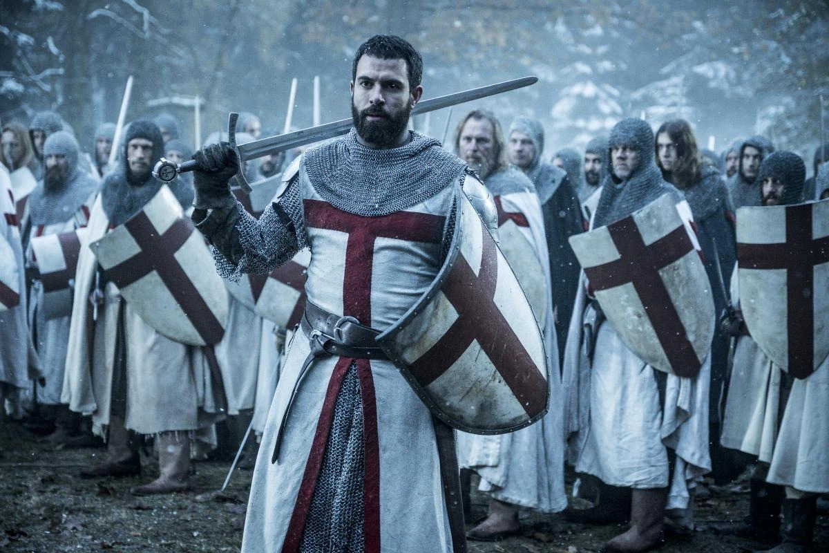
The Templars’ Rule enjoined humility upon the brother knights. Many of the secular knights of the time were psychopathic peacocks, men capable of extreme violence who also flaunted the richest and most elaborate clothing they could afford. Fur, jewellery or rich clothing was forbidden the Templars as was the decoration of their horse’s harness with gold and silver. The Templars were to wear simple white, their horses to be harnessed in plain leather. As for their appearance, they were to have their hair and beards trimmed regularly. The Order was to be ordered outside as well as within.
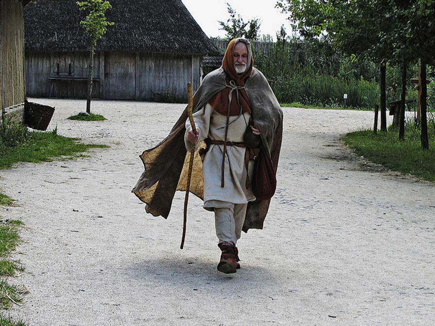
The conquest of Jerusalem in 1099 reoped the Holy Land to Christian pilgrims. Hearing the news of the success of the First Crusade, people started setting out for Jerusalem from all over Europe. One of the first was an Englishman, Sæwulf. On his return, he wrote an account of his travels and adventures. Pilgrimage was hugely popular during the Middle Ages and, as the Canterbury Tales attest, there were many motivations apart from piety for making such long and difficult journeys. However, Sæwulf was a serious pilgrim, who ‘though conscious of my unworthiness, went to offer up my prayers at the Holy Sepulchre’.
Having reached Italy, Sæwulf embarked upon a ship for the Holy Land from Monopoli, near Bari in the heel of Itlay on 13 July 1102 – only for the ship to be wrecked the same day. Not one to be put off, Sæwulf found another ship and tried again. It took thirteen weeks to sail from Italy to the port of Jaffa, with many storms and ports of call along the way.
With the Holy Land waiting, Sæwulf and his companions decided not to wait overnight on their ship of passage and hired a boat to take them ashore. Their fervour saved them. A storm blew up over night, wrecking the ships anchored in the harbour. A thousand pilgrims drowned without ever setting foot in the Holy Land.
In his account, Sæwulf recorded the dangers of the road from Jaffa to Jerusalem, telling of the pilgrims killed by the bandits who haunted the Judean hills. Their corpses marked the trail from the port to the holy city. Having survived the journey to Jerusalem, Sæwulf visited the holy sites of the city before travelling through the rest of Palestine, recording the devastation he found, with many of the churches and monasteries having been destroyed by the Saracens. Once he had ‘visited and paid our devotion at all the holy places in the city of Jerusalem and the surrounding country’, Sæwulf returned to Jaffa, embarking for his return journey on 17 May 1108. He had been in Palestine for nearly six years.
Nine men lay prostrate on the floor of the holiest place in Christendom on Christmas Day, 1119.
The place was the Church of the Holy Sepulchre in Jerusalem, and it had been twenty years since the knights of the First Crusade had taken the city in blood and war.
The leader of the men was named Hugues de Payens. Among the other eight were Godfrey of Saint-Omer, Geoffrey Bissot, Payen of Montdidier, André of Montbard and Archambaud of Saint-Aignan. Their prostration was the climax of the vows these men were taking, vows of poverty, chastity and obedience.
These were the standard monastic vows of the Church, and there would have been little to set their vow taking apart from those professed by thousands of other monks if not for the name by which they proposed to call their confraternity: ‘The Poor Fellow-Soldiers of Jesus Christ’. For these nine men were swearing their lives to Christ and their swords to the protection of their fellow Christians in the Holy Land, the newly conquered realm of Outremer.
But, at the time, barely anyone noticed. There was no chronicler writing down an account of what happened. We don’t even have a complete list of the names of all nine men. Indeed, there might have been as many as thirty men lying on the floor of the holiest church in Christendom that Christmas Day – the sources, which were all written considerably later, disagree. This is hardly surprising. The 12th century was a time of extraordinary monastic renewal, with new orders springing up all over Europe. Of these, some lasted a few years, some a few decades, some continue to the present. But it was hardly unusual that a group of men should be making vows before God, and only the people present in the church at the time would have paid it any heed – then as speedily forgotten all about it when they emerged, blinking, into the cold clear light of a winter’s day in Jerusalem.
Hugues, the leader of these ‘Poor Fellow-Soldiers of Jesus Christ’ was born, probably in Payens, somewhere around 1070. Almost nothing is known of Hugues’ early life. However, he was clearly a member of the knightly caste, for his name appears, appended as a signatory, to a number of charters (documents recording the transfer of land or privileges) pertaining to the estates and properties around Payens. Payens, now known as Payns, lies on the River Seine, downstream from Troyes and 80 miles south west of Paris.
Hugues de Payens was probably one of the retainers of another Hugues, the Count of Champagne (has there ever been a more splendid title), who ruled his principality from his seat at Troyes. Hugues of Champagne was both pious and unhappily married: a situation calculated to make a man take up the cross. Which is exactly what Hugues of Champagne did, twice, first in 1104, spending four years in Outremer, and then again in 1114. While we don’t know if Hugues de Payens accompanied his overlord Hugues on his first journey to the Holy Land, it seems highly likely that he went with him on the second trip.
But when the Count of Champagne returned to France and his loveless marriage, Hugues de Payens remained in Outremer. With his companion, Godfrey of Saint-Omer, Hugues came up with the idea of founding a fraternity of knights that would follow the religious Rule (essentially, a monastic manual, regulating the lives of monks) of Augustine of Hippo while seeking to protect the stream of Christian pilgrims coming to the Holy Land in the wake of its liberation from its Muslim conquerors.
It is not hard to see why Hugues and his companions thought that this was necessary. Although the First Crusade had succeeded, against all odds, in capturing Jerusalem in 1099, and founding the kingdoms of Outremer, the Holy Land was by no means secured. In response to the success of the Crusade, hundreds if not thousands of Christian pilgrims started to make their way to the Holy Land, but the journey there, whether overland or by ship, was perilous, and never more perilous than when they actually arrived in Palestine. The most usual pilgrim route was to take ship to Caesarea or Jaffa on the coast before trekking to Jerusalem.
But the tracks through the Judaean Hills were rife with Saracen marauders and brigands. Pilgrims who went unarmed, seeking to follow in the footsteps of Christ, were all too likely to be killed or taken as slaves. Indeed, events earlier in 1119 may well have served to convince Hugues of the necessity for this military monastic order.
On Easter Saturday, 1119, which in that year took place on 29 March, pilgrims had gathered in the Church of the Holy Sepulchre for the solemn vigil that accompanied Christ’s journey into Hell following his Crucifixion, in order to free the souls of those held there. Pilgrims still gather in the Church of the Holy Sepulchre on Holy Saturday and, like those waiting on 29 March 1119, they are waiting for the miracle of the Holy Fire. This is when an unlit lamp placed upon the rock where Christ’s body was laid bursts spontaneously into flame: the patriarch of Jerusalem then emerges from the tomb, bearing a taper lit from the new fire, and lights the candles of the pilgrims waiting in the dark, in the church. There are, of course, both sceptical denunciations and pious defences, but its importance in history is its continuation.
On 29 March 1119, only twenty years after the recapture of Jerusalem, the assembled pilgrims in the church, having witnessed the event and seeing the new flame burning, burst from the church, intent on seeking a new baptism in the River Jordan. The river lies 20 miles east of the city, so it required a real outpouring of religious fervour to think to make it that far. But none of them made it. Many hundreds were killed by Muslim raiders; those few who survived were taken as slaves.
The Crusade had been launched in part because of the increasing dangers of making a pilgrimage to the Holy Land when it had been under Muslim rule. Now, even though Jerusalem was in Christian hands, it must have seemed that pilgrimage was no safer than it had been before. Outremer trembled on the brink of perpetual war, its rulers always hampered by a chronic lack of manpower. Most of the men who had conquered in 1099 had returned home: Godfrey of Bouillon, the man entrusted with safeguarding the Kingdom of Jerusalem, was left with 300 knights and a thousand foot soldiers. Twenty years later, under the new king of Jerusalem, Baldwin II, the manpower situation remained desperate. Many hundreds of trained knights had come as pilgrims to the Holy Land in the two decades since the capture of Jerusalem, but once their pilgrimage was completed, there was no obvious avenue by which they could use their skills in the way that would best serve the kingdom: through their martial training.
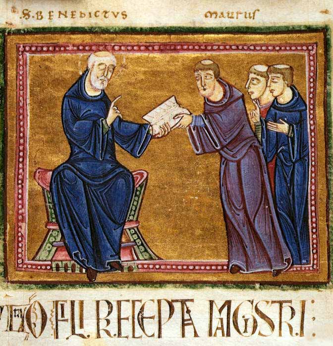
Hugues of Payens, though, did not return home once his pilgrimage was done. In company with other knights, he took to hanging around at the place that was the obvious centre of their world: the Church of the Holy Sepulchre. There Hugues met other knights, who had looked round at the perilous situation in Outremer, and were similarly looking for a way to make a difference. Given the primacy always placed upon Hugues in the later accounts, we must assume that it was he who first came up with the idea of a military confraternity to protect pilgrims and the holy places. The need for such an order was all too obvious. So, with his eight companions, Hugues received permission from Gerard, the prior of the Holy Sepulchre, that they might make their vows in the most sacred church in Christendom. The order of The Poor Fellow-Soldiers of Jesus Christ had begun.
One of the key events in European history that helped to conflate the ideas of sorcery and heresy was the trial and condemnation of the Poor Fellow-Soldiers of Christ and of the Temple of Solomon, the Knights Templar.
King Philip the Fair of France, having determined to destroy the Knights Templar to obtain their resources and negate his huge debts to them, needed a pretext. The Knights had a reputation for secrecy that had allowed rumours as to their practices to flourish. At dawn on Friday, 13 October 1307, Philip’s agents arrested the master of the order and its highest officers, and put them to torture. The warrant for their arrest began with the telling phrase: “Dieu n’est pas content, nous avons des ennemis de la foi dans le Royaume” [“God is not pleased. We have enemies of the faith in the kingdom”].
Under unimaginable duress, they confessed to heretical acts, blasphemy and sorcery. Although there was little basis in these accusations, they provided sufficient pretext, when combined with the pressure Philip placed on the trial judges, to ensure the condemnation and execution of Jacques de Molay, the order’s Grand Master, and the suppression of the Templars. As well as connecting sorcery and heresy in the European mind, it also prefigured another key aspect of later witchcraft trials: that the prosecuting authority was not the church but the secular authorities.
Listen. Do you hear? That sound. That is the sound of lamentation. Sigurd the dragonslayer and Brynhild the Fair are dead. The trees whisper it, the rivers carry tidings to the heaving, restless sea; the rain and the wind, the sun and the stars tell the news: Sigurd is dead. Brynhild has departed.
There was a man who heard the whisper of rain and wind, who saw the tears of the sun and the grief of the stars. That man was Heimir, foster-father to Brynhild, and his grief for the fair Brynhild was as great as if she had been the daughter of his loins. Then Heimir laid down his plough and put aside his crown and forsook his kingdom. For Brynhild and Sigurd had had a daughter, Aslaug, and they had asked Heimir to take her as foster-daughter in turn. However, Aslaug being yet only three years old, Heimir had not yet brought her to his own kingdom. But now Heimir put aside all else, even his grief, and rushed to Aslaug. For Sigurd had thrown down many men in his might and now that he was dead and fear of him no longer held his enemies in thrall, they would seek vengeance on his living memory, that the seed of Sigurd and Brynhild be utterly destroyed in this middle-earth.
Heimir brought Aslaug back to his kingdom, Hlymdal. But soon the news began to spread that the flesh of Sigurd and Brynhild lived with Heimir. For Aslaug, even as a child, was too beautiful not to be marked. Rumour spread, faster than frost: the child of Sigurd and Brynhild the Fair lives in Hlymdal. Heimir, listening, heard the howling, distant but coming closer. The wolves were gathering.
There was no keeping Aslaug in Hlymdal. But Heimir realised that he could not just flee, for wherever he went, the girl’s beauty and bearing would tell her lineage. No, he must go, but in going keep his foster-daughter hidden, always, when they were in sight of men.
So Heimir had a marvellous harp made with cunning and craft that Aslaug, who was yet little, might be hidden within it. And with her, in the harp, Heimir stowed precious things: gold and silver, and fine clothes, for he foresaw that they would travel far. Then, leaving his kingdom, Heimir set forth, a wanderer, a beggar carrying a harp that he might play for his supper and his bed. They wandered far. Whenever they were far from the eyes of men, Heimir would take the harp apart and let little Aslaug bathe. For food while Aslaug was shut in the harp, he gave to her a wine-leek for its virtue is such that a person may live long on it, even when she has no other food to eat. And when Aslaug cried, for fear of the dark and the confinement of her safety, Heimir would play the harp, quietening her, for he was marvellously skilled at the harp.
In his wanderings, Heimir came to Norway, to a farm called Spangareid. An old couple lived there, Áke and his wife Grima. But when Heimir knocked on their door, Grima answered, for old Áke was gone to the forest where he was chopping wood.
“Why come you here, stranger?” Grima asked.
“I mean you no harm, old woman,” said Heimir. “I am a wanderer, a beggar, far from home. I ask only space near the fire that I might warm these old bones.”
“You’ll be asking me to feed you once you’re sitting by the fire, I’ll be bound,” said Grima.
But Heimir held up his hands, blue with cold. “I am a harpist. I want only to warm these fingers before the black cold takes them.”
“All right,” said Grima. “I’ll let you in. No food, mind. We’ve none to spare for beggars.”
As Grima fed the fire, Heimir set his harp down beside him then held his hands to the flames. But Grima, sharp-eyed, sharp-tongued, sharp-witted Grima, saw something hanging from the harp and as she bustled around the farmhouse she looked closer and saw it was a piece of the richest cloth. Then, looking to Heimir, she saw gold glint through the rags wrapping his fingers. Grima realised that this was no ordinary beggar.
“Listen, beggar. I spoke harshly to you, for we see few enough people here on our farm. Stay a while, for my husband will be back soon from the forest, and I will give you to eat, and a place to sleep tonight.”
Heimir looked at the crafty old woman but the snow blindness dimmed his sight and he did not see the guile glint in her eye.
“I am grateful, old woman. I fear another night in the open would be the end of me.”
“Let me show you where you can sleep.”
So the old woman took Heimir to the barley barn and he lay down there, with the harp beside him, to sleep amid the warm sacks of barley.
While Heimir slept, Grima set to her tasks, but she was too excited to do much. So when Áke, her husband, came home, he found the house unswept, the fire unbanked, and the animals not fed.
Áke looked round, then looked to sharp-eyed Grima and said, “You must be very happy. For every day, I work, chopping wood and hauling it home until my fingers bleed while you sit by the fire and do nothing.”
Then sharp-tongued Grima said, “Would you like to do the work of a moment and, by that work, keep us fat and contented all the rest of our lives?”
“What work is that, old woman?” asked Áke.
“A man came to our farm today. An old man, a beggar he said. But I saw, with these sharp eyes, the gold glint from his finger and gold cloth in his harp. He is very old but I think he must have been a great warrior when he was young. I put him in the barley barn and he is lying there.” Grima looked at her husband. “Fast asleep.”
But Áke shook his head. “No. No. I will not do this thing that you ask.”
Sharp-tongued Grima cut him with her tongue. “Why did I marry a weakling? My mother told me to marry Svein. He wouldn’t have hesitated. If you won’t kill him, Áke, then so help me, I’ll take the beggar man for my husband and we’ll drive you out. You weren’t here when he came: you didn’t hear the honey words he poured over me. But I would not listen – I vowed to stay true to my husband. Much good that does me! Mark this, Áke, and mark it well: I’ll take him to my bed and kill you if you don’t take this chance.” Grima put her hand on Áke’s arm. “We won’t get another chance like this, Áke.”
Then Áke nodded his head and he took his axe and sharpened it. Grima brought Áke to where Heimir lay sleeping, the harp by his side. He was snoring.
“Do it!” whispered Grima. “But run away after you strike, lest he lay hand on you.” Then Grima took the harp and ran back to the farmhouse.
Áke took his axe and stood beside the sleeping, snoring Heimir. He raised his axe and brought it down but, striking, the axe caught on bone and flew from his hands. Heimir roared from his sleep, limbs thrashing, and Áke fled from the barn. But the blow was deep, a death blow, although such were Heimir’s death throes that the whole barn came down about him.
Áke found Grima in the farmhouse with the harp.
“It’s done,” he said.
“We’ll be rich,” said Grima. “Mark my words.”
But the old man shook his head. “This won’t end well. His blood will bring down blood on us.”
“Pah,” said the old lady. And she opened the harp.
But, inside, they found a little girl, although there was also gold.
“This will end badly,” said Áke.
“It’s true,” said Grima, “she is not what I expected. Who are you?” But to whatever question they asked, Aslaug gave no answer. It was as if she had no speech.
“This is bad,” said Áke.
“Nonsense,” said Grima. “I need some help around the house. She will be called Kráka, after my mother, and I will say, if anyone asks, that she is our daughter.”
“No one will believe you,” said Áke. “We’re both so ugly. No one will believe Kráka is our daughter.”
“I will make her ugly,” said Grima. “I will shave her head, and tar it, and dress her in rags, so people will think she is my daughter. Besides, husband, don’t you remember how beautiful I was in my youth?”
Áke looked at her. “No,” he said.
“Oh, shut up,” said Grima. And she set the girl to doing all the hardest chores on the farm. There Kráka grew up, in poverty and silence.
*
In Gautland there was a jarl named Herrud. He was wealthy and powerful, and he had a daughter named Þóra. Of all women she was the most beautiful and her manner was as lovely and gracious as her appearance. Her nickname was Fortress-Hart, for she excelled other women as the deer excels other animals. Herrud doted on his daughter, and had a bower made for her use, near his hall. Every day Herrud would send Þóra a gift. One day he sent her a little snake of great beauty. Þóra liked the snake and put it in a box with a piece of gold for its bed. But at once the snake began to grow, so that within a few days it was too big for its box, and it lay curled round it. Once out of the box, the snake grew the quicker, so that it soon lay wrapped around Þóra’s bower and none might enter or leave save only the man who brought the serpent its food: a whole ox. The gold beneath the snake grew with it too, so that it lay upon a great hoard. Then Herrud swore an oath that whatever man killed the snake and freed Þóra would have Þóra as his wife and the snake’s gold as her dowry. Many men heard this, but none dared to face the serpent, for it had grown very great indeed.
The king of Denmark was Sigurd Hring. His fame was great, for he had killed Harald Wartooth at the battle of Bravellir.
Ragnar was son of Sigurd. He was a giant among men, handsome, feared by his enemies and beloved of his friends. He had already gathered men to his warship and earned a reputation as a great warrior when he heard of the promise Jarl Herrud had made. But Ragnar made no oath, nor did he talk of the serpent that had imprisoned Þóra. Instead, he had some clothes made: shaggy trousers and a shaggy cape, which he boiled in tar. Then he sailed to Gautland and pulled his warship up on a beach not far from Jarl Harrud’s hall. But Ragnar did not go to greet the jarl that night. Instead, he woke early, before anyone else had got up, and Ragnar put on the tar-covered trousers and cape he had made, and he took a spear from the rack. Climbing down from his ship, Ragnar rolled on the beach, covering his trousers and cloak in sand. Then he removed the rivet holding the spear head on its shaft.
Ragnar went through the dawn to the jarl’s hall. All were sleeping there. Ragnar went to Þóra’s bower. He saw the serpent coiled round it, asleep. At once, he stabbed it with the spear. Pulling the spear out, he stabbed again, cutting through the serpent’s spine, and he twisted the spear so the spear head broke off.
In its death throes, a stream of acid blood gushed from the serpent, striking Ragnar. But the shaggy cloak and shaggy trousers protected him from the deadly blood.
Þóra, wakened by the death agony of the serpent, saw a hooded man striding away and she called after him. But Ragnar did not turn, and answered in riddle, before walking away.
Þóra wondered who the man might be who had killed the serpent and freed her: could such a giant be a man? When Jarl Harrud, wakened by the serpent’s death thrashing, came he found the spear point embedded in the animal’s spine but so great was its size that Harrud too wondered if a man could have wielded such a weapon.
Then Þóra advised her father to call a great assembly of the people. For whoever had killed the serpent would carry the shaft that fitted the spear head that had slain the snake.
Ragnar and his men heard the call to assembly and went to it, sitting apart from the other men.
Jarl Harrud stood and spoke to his people. “The snake that held my daughter captive is dead and the man who killed it left in the beast its death. Let he who wielded that spear bring it forward and I shall keep my promise to him, whatever his degree.” Many men tried, but no one had a spear shaft that matched the spear head.
Then Ragnar stood forth, and claimed the spear was his, and fitted the spear head to the shaft he carried. News of this deed spread through all the Northlands and beyond; Ragnar’s name was sung from the white north to Miklagard itself. Jarl Harrud, right glad at so worthy a match, gave Þóra to be Ragnar’s wife, and he took her home to Denmark. Ragnar loved Þóra and she gave him two sons, Eirek and Agnar. They grew to be great men.
But then Þóra took sick and died. In his grief, Ragnar put aside his kingdom, giving it to the keeping of others, and to still his sorrow he took his warship and went viking.
One morning when they were anchored in a small inlet, Ragnar’s men woke early and took the rowing boat and rowed to land to bake bread. On the beach, they saw a farm not far away and the men took their wheat to the farm so that they might use its oven. An old woman greeted them, chewing her breakfast though she had no teeth. The men asked her name and the old lady said, “My name is Grima. Who are you?”
“We are the men of the great Ragnar Loðbrók. Now help us bake his bread.”
But the old woman held up her hands. Her fingers were twisted and bent. “These old hands can’t do such hard work. But I have a daughter who can do the baking for you. Her name is Kráka, but she has grown so headstrong I can bare control her. Ask her yourself when she gets back.”
For Kráka had taken the cattle to water in the morning. But as she watered the cattle, she had seen the great ship, moored in the inlet, with painted shields lining its sides and the painted head of a great serpent at its prow. Seeing the ship, Kráka undressed and washed herself, despite Grima having forbidden it. Then she brushed her golden hair that had grown long, hanging down to the ground. For few people came to Spangareid and, with so few visitors, Grima had grown lazy and stopped shaving the hair from Kráka’s head.
Leading the cattle, Kráka came home. And the men, bent over the fire, stopped what they were doing when they saw her and they turned to Grima and asked, “Is this your daughter?”
“She is,” said Grima.
“How can that be,” said the men, “when she is so beautiful and you are so ugly?”
“Don’t judge this old woman in her age: I was a beauty too when I was young.”
The men asked Kráka to help them bake the bread, telling her to knead the dough into loaves that they would then bake. Kráka bent over the dough, kneading it, then handing it to the men when each loaf was ready. But the men could not stop turning to stare at her, so that they burned all the bread as they baked it.
The bread baked, although burnt, they returned to the ship. But when they served the bread to the crew, the crew complained that they had never been given such burnt bread.
“You had one task,” said Ragnar, who hungered. “You could not even do that.”
“It’s not our fault,” said the men. “There was this woman there, and she was so beautiful we could not stop staring at her, and so we burned the bread.”
“No woman is as beautiful as Þóra,” said Ragnar and his voice was low and threatening.
But the men, desiring to excuse themselves, did not hear the threat but protested all the more that the woman they had seen was indeed more beautiful than Þóra.
Then Ragnar spoke. “I will send other men and they will bring back report of this woman of whom you speak. If it be as you say, then I will pardon your incompetence. But if she be one whit less beautiful than Þóra, then you will die.”
But when Ragnar’s messengers tried to sail to the beach, the headwind was too great and they could not reach the land.
Denied, Ragnar’s eagerness to see this maiden waxed and he told his men to give her this message: “If she is truly more beautiful than Þóra, then I want her for my bed. Tell her I will meet her, but that she must come to Ragnar Loðbrók naked but clothed, full yet hungry, alone and with company.”
When the wind turned, Ragnar’s messengers set sail. They landed and went up to the farmhouse and found Kráka waiting for them there. Then they looked upon her and saw that the reports of her beauty were nothing less than the truth: she was indeed more fair than Þóra the Fair. Then the messengers bowed before her, and told her they came with word from Ragnar Loðbrók, renowned throughout the northlands. And they gave her his message.
Grima, hearing it, cackled. “The famous Ragnar is mad. No maid may come to him in such a way.”
But Kráka said, “I will come to your ship tomorrow, as the great Ragnar Loðbrók commands.”
She watched the messengers sail back to Ragnar’s warship, moored in the bay. And through the night, Kráka thought upon Ragnar’s message. Then, when dawn was breaking, she went to see Áke. The old man was chopping wood. His dog, the only creature he loved, snarled at Kráka when he smelled her, but she ignored the animal.
“Will you lend me your fishing net?” Kráka asked him. “I will catch us some fish for our lunch.”
“Take it,” said Áke. “Saves me getting wet and cold, standing in the bay.”
“I’ll need to take the dog too,” said Kráka, “or the gulls will steal the fish.”
“About time someone else did some work round here,” said Áke. “Go with her dog.” The dog, disguntled, followed Kráka back to the farmhouse. In the house, Kráka took an onion, then stripped her shift off and, naked, wrapped Áke’s net around her body and draped her long hair over her breasts.
“Come, dog,” Kráka said and, with the animal following, she went down to the bay. Grima, returning from the well saw her walking down to the beach: naked yet clothed, alone but with company. And she realised, suddenly, the wit of the girl who had been so long her drudge.
“But she is not full yet hungry.”
Then Grima saw Kráka raise the onion to her lips, bite into it, chew and then spit it out.
“Ragnar will smell the onion and know she has eaten but is not sated.”
Overnight, Ragnar, eager to see the fair maid, had moved his warship closer to the beach. Now, seeing her upon the strand, he called to her, asking if she was the one whom men said was fairer than Þóra the Fair.
“I come at the bidding of Ragnar, renowned through all the northlands – no maid would dare refuse him. As you commanded, I stand before you naked yet clothed, neither hungry nor full, alone but with a companion.”
“Come to me,” called Ragnar.
“I will come to you if you promise me and my companion safe conduct,” said the brave maiden.
“You shall have it,” said Ragnar. He sent his men to row her to the warship.
When Kráka stood before him, naked yet clothed, the blood rose in Ragnar Loðbrók as it had not done since Þóra took sick, and he reached for her. But Áke’s dog, seeing this, bit Ragnar’s hand. Then Ragnar’s men prised the animal’s jaws apart and pulled it off the king and strangled it. Thus died the only creature that Áke, the old man, loved.
The wound was not deep, and Ragnar seated Kráka beside him while it was bound and spoke with her.
“The kindness of a king might expect to be repaid by the embrace of a fair maid,” he said, and as he spoke he had his men lay out rich cloth and gold and jewels before Kráka.
But the wily maid replied, “A true king keeps his word. You have promised me safe conduct: surely you will honour your oath and let me go hence, a maid intact.”
Ragnar looked upon Kráka and saw that she was truly more beautiful than Þóra. So he said to her, “I would wish that you come with me.”
Kráka shook her head. “I know well you have set forth upon some task: you are a-viking, and it may well be that when you return you will have forgotten me. But know this, O King. If, when you sail again past the farm at Spangareid, you remember me, then I will give thought again on coming with you to your land.”
Ragnar had his men bring forth a dress of woven gold, one that Þóra herself had worn, and laid it before Kráka.
But Kráka refused the gift. “What suits this maid, who drives the goats and cattle to water, are rags, not the fine clothes of Þóra the All-Fair. Nor can I wear such clothes while I live with Grima and Áke. But if you still wish me to go with you when you return, then send your men to call for me and I will listen to their words.”
Ragnar swore oath upon his gold armband that he would not forget Kráka. But Kráka gave him no more answer, and Ragnar had his men take her back to shore. Then, with the wind shifting, Ragnar set sail, to finish his viking.
But always before his eyes was the memory of the maid who had come to him naked and yet clothed.
Then came the evening when, looking to the bay, Kráka saw the snake-prowed ship riding there, and men rowing to shore.
“The king has returned for you, as he swore,” they said.
“I will come with you in the morning,” said Kráka. “I must make my farewell.”
As the sun rose, Kráka went to where Grima and Áke lay abed.
“You think me too young to remember what you did when first I came to you: how, though bound by guest law, you killed my foster-father, Heimir the Faithful. But I remember well.” Kráka pointed at Áke. “I killed the dog, which alone you loved, for in truth none could love Grima Sharp-Tongue. I could have paid you back myself, killing you as you slept just as you killed Heimir, but in memory of the years I have lived with you I have stayed my hand. But know this: I now pronounce your doom. From today, each day that passes shall be worse than the day it follows, and the worst shall be your last. Now, we part forever.”
Then Kráka went to where the boat waited for her, and she boarded Ragnar’s warship. The king welcomed her but when night came and he would sleep with her, Kráka refused.
“Before I come to your bed, I would have a wedding feast, and a welcome in your land, that any heirs I bear for you be accepted by all.”
Ragnar, hearing the wisdom of this, accepted, but urged his men to sail all the faster.
Then, coming to his kingdom, Ragnar ordered a great wedding feast and Ragnar and Kráka were married. But that night, when Ragnar would lie with her for the first time, Kráka put her finger to his lips.
“Wait,” she said. “You have waited long, but wait three nights more. For if we share a bed tonight, then my heart tells me the child I bear shall suffer for our impatience.”
But Ragnar roared with laughter. “I have waited months, Kráka, months. I have given you gold and silver, my kingdom and my heart. I will wait no longer.”
So that night they were joined, and their marriage healed the pain of Þóra’s loss. But the telling of Kráka’s heart proved true, for their first child, born of that first coupling, was born with gristle where his bones should have been, and he was named Ivar the Boneless. Though boundless in wit, his men had to bear him on their shields for he could barely walk.
There were other sons born to Ragnar and Kráka: Bjorn, Hvitserk and Rognvald. But some of Ragnar’s men began to whisper that it was not fit for so great a king to be married to a peasant. Eystein, king of the Swedes, had a daughter of great beauty. Better for Ragnar to put Kráka aside and marry the daughter of a king. But Kráka, hearing tell of this, spoke to Ragnar when they lay abed and told him the tale of how she was Aslaug, the daughter of Sigurd and Brynhild the Fair. But Ragnar would not believe her tale. Then Kráka said, “If my words be true, then the son who sits now in my belly will bear a mark like a snake lying in his eye and you will call him Sigurd Snake-in-the-Eye.”
So it was. Kráka gave birth to a baby boy and when he opened his eyes for the first time, Ragnar saw there a mark like a coiled snake. And all men came to know that Kráka was, in truth, Aslaug, daughter of Sigurd Dragon Slayer and Brynhild the Fair.
The tale of their sons is told in the saga of the sons of Ragnar. There too is told of how Ragnar met his death when King Ælle cast him into a pit of serpents, and Ragnar had his end by the bite of a snake who had first gained his glory by the slaying of the great serpent. There too is told how the sons of Ragnar took terrible vengeance for the killing of their father, and many other things beside. But now, this tale of Ragnar Loðbrók is done.
It was a brilliant stroke, an attack, through the dark and chill of a winter’s night, that won a kingdom. Guthrum led his Viking war band south, riding hard from his base in Gloucester, heading for the royal estate at Chippenham. They were going to kill a king.
Traitors At Home
Riding fast, the Viking war band made its way through the winter locked countryside. Although they rode through Wiltshire, land owing fealty to Alfred, king of Wessex, no hands or swords were raised against them. Their lord, Guthrum, had made his preparations well. In the months before their winter ride, Guthrum had made surreptitious contact with the ealdorman of Wiltshire, one Wulfhere. Like many of the great men of Wessex, Wulfhere had lost faith in his young king, Alfred. The agents Wulfhere had received from Guthrum during the autumn of 877 had whispered promises to him, promises of preferment, possibly even of a throne. For the Great Heathen Army that had conquered the Anglo-Saxon kingdoms of Britain over the last 12 years had in Mercia and Northumbria installed client kings rather than ruling directly. For Wulfhere, maybe the prospect of a throne, even one held at the behest of Guthrum, might have seemed more attractive than more years bolstering Alfred’s uncertain regime. Whatever the blandishments or threats uttered by Guthrum’s agents, they worked. On that night in early January, the men that Wulfhere had set on the border between Anglo-Saxon Wessex and Danish-controlled Mercia stood aside as the king of the Danes rode past them.
To Catch a King
For Guthrum, this was the final push towards making himself the pre-eminent king in Britain. Already king of East Anglia, and with a puppet installed on the throne of Mercia beholden to his support, only the kingdom of the West Saxons held out against him. This winter attack was Guthrum’s third attempt to crack the Wessex nut and, as with his other attacks, he carried it out with his customary secrecy and speed. The aim was nothing less than to kill the king, celebrating the last days of the long Christmas feast at his royal estate in Chippenham. After a week or more of feasting, Guthrum hoped to find Alfred and his retainers bloated with food and sodden with drink: ready pickled for the killing.
But word reached Alfred just in time. Perhaps one of Wulfhere’s men, gagging at the silence enjoined on him by his ealdorman, rode south ahead of the Danes, bringing warning to Alfred and his family. As the realisation sank in, Alfred was faced with a sudden, life-or-death choice. Stay, and make a stand with the men of his household, or run. Part of Guthrum’s appeal to the disaffected magnates of Wessex was that their young king was unable to protect them. By running, Alfred would be making that claim real: he was unable even to protect his own family. But staying meant a fight against unequal odds with Guthrum’s picked assassination squad.
King on the Run
Alfred ran. With his family and the men of his household he fled, heading west, towards the marshes of Somerset. Arriving at the all but deserted hall, Guthrum pulled the news of the direction of the king’s flight from a left behind servant. And, hearing the news that Alfred had fled to the west, Guthrum smiled. He had planned for this. If the young king escaped the net in Chippenham, Guthrum had cast another to catch Alfred as he tried to escape. Another Viking army, led by Ubba, the last survivor of the sons of the legendary Ragnar Lothbrok, was even now sailing down the Bristol Channel to make landfall in north Devon. Alfred was about to be caught between two armies. The hard Wessex nut was shortly to be cracked.
But this was when Guthrum’s carefully worked out strategy started to unravel. Despite Ubba’s fearsome reputation and the fact that he was carrying the fabled raven banner of the sons of Lothbrok, the army he led was defeated and Ubba himself was killed by a surprise attack from the army of Odda, the loyalist ealdorman of Devon. As for Guthrum, finding himself now tied down having to defend fixed positions as Alfred launched a guerrilla war against him from his stronghold in the Somerset levels, the Viking leader suddenly realised the difficulty of fighting a war against an enemy that could choose where and when to fight. Alfred was starting to out Viking the Viking.
The Final Battle
So it came as a considerable relief to Guthrum to learn, early in May of 878, that Alfred had emerged from the marshes and was assembling an army at Egbert’s Stone east of Selwood Forest. Guthrum had fortified Alfred’s base at Chippenham during the last few months as he had tried to bring Wessex definitively under his control. Now, with Alfred coming out into the open, the matter was there for the settling.
For Guthrum, the news must have brought more relief than trepidation. His men were professional soldiers and now, finally, they would have a chance to come to grips with the phantom that had plagued them these past months. Faced with his own strategic choice – whether to remain behind his defences at Chippenham or to march out to meet Alfred in battle – Guthrum did not hesitate. He marched. With the advantage of mobility – most of his forces had horses – he called in all the patrols that could reach him in time and set out, south from Chippenham. Alfred had come out of the marshes, but Guthrum would choose the ground of their final meeting.
Showdown
With his scouts reporting that Alfred was marching towards Chippenham, Guthrum reacted immediately. Leaving a small garrison in his base, Guthrum marched the Great Army south to intercept the army of Wessex. He took up position on Bratton Castle, an Iron-Age hillfort on the western edge of Salisbury Plain. The old hillfort, long abandoned but with its earth banks still impressive today, rose 740 feet (225 metres) above the farmlands running north towards Chippenham (the Westbury White Horse, a chalk figure cut into the grass, lies on the side of the hill, documented from 1742). From its vantage point, Guthrum could keep watch for miles around for Alfred’s army. Without a water source, it was no place for a main camp, but it was ideal for reconaissance, and provided the high ground should Alfred be willing to close on Guthrum.
As Alfred marched north his scouts brought back their reports: Guthrum had left Chippenham and taken up position on the fort of the old people. Soon, the king could see for himself the Great Heathen Army, their spear points glinting as they looked down from Bratton Castle. Although Alfred had attacked up hill at the Battle of Ashdown, here it was out of the question; the slopes were too steep. But rather than occupying the summit of a hill, Bratton Castle lies on a long ridge. Alfred could lead his men up on to the ridge and then advance on Guthrum. But, shading his eyes to take in the enemy position, Alfred must have grudgingly acknowledged Guthrum’s field skill: by positioning himself on the narrow ridge, the Viking leader had ensured that his shieldwall could not be outflanked. Thus, at one stroke, Guthrum had neutralised Alfred’s advantage in manpower. The Great Army had been whittled away in the previous months.
Choosing the Ground
However, with the narrow neck of land atop the ridge, and the careful use of the ditches marking out the hillfort, Guthrum could funnel Alfred’s shieldwall tight, so it could not come around to outflank him. As Alfred led his army on the long march up hill, the king would have been all too aware that the battle he was about to enter was going to be a brutal and bloody shoving match.
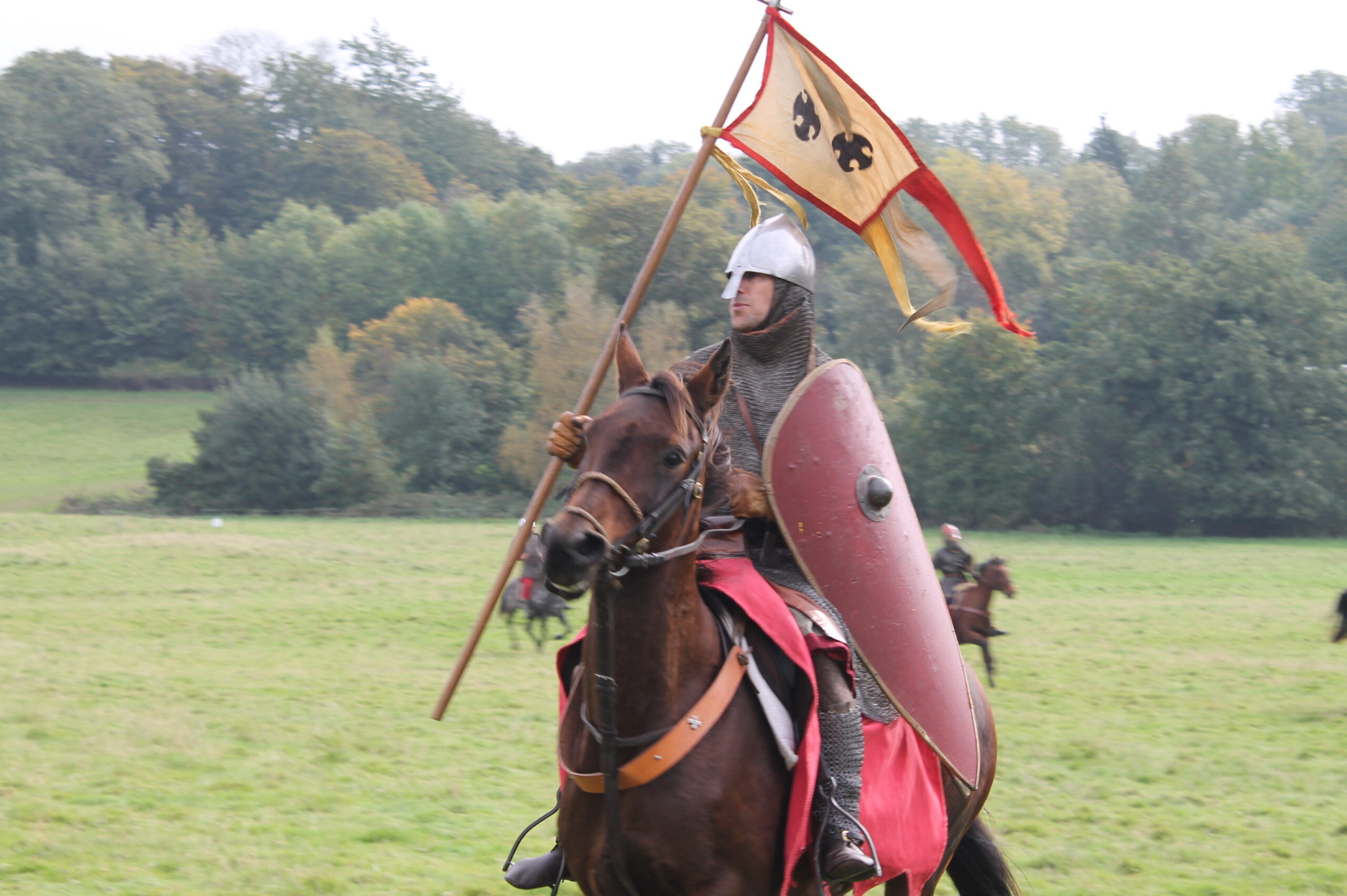
As the two kings dressed their lines, high above the Wiltshire Plain, they both knew this was the crucial battle. The battle-hardened warriors of the Great Heathen Army knew what they were about: they had had years of virtually unbroken conquest and, while their confidence may have been knocked by the unexpected defeat and death of Ubba, there was no reason for them to expect the fate weavers had started sewing a different pattern. The core of Alfred’s army was made up of his personal retainers, man for man, as good troops as the warriors of the Great Army. But the majority of Alfred’s army were not trained soldiers, but farmers and artisans, free men who owed service to their lord, and who fought for their families and their land. Such men marched to battle with whatever weapons they had to hand. Among these men there would be barely an item of armour, and precious few, if any, swords.
Preparing the battle space
The Northmen waited, in solid line, their painted shields interlocked, spears prickling out through the wall like a porcupine. As the army of Wessex approached, the commanders detailed to each flank pushing the men on the inside tighter to stop the shieldwall spreading, the men drummed on the rims of their shields. Boasts, insults, threats rang out as the lines closed and it became clear, to each man in the converging shieldwalls, whom he would face in the enemy line. This was war at its most up close and personal.
In these battles there was none of the clouds of gunpowder smoke that would obscure later battlefields – everything was stark in its clarity. But kings could not take advantage of this clarity by standing back and directing the battle; of necessity, their place was in the centre, in the front rank.
Size does matter
As the battle wore on, sheer fatigue started to play as much a part as battlefield losses. And this is likely where Alfred’s advantage in manpower started to pay off. The sources tell us the battle lasted a long time, long enough for the adrenaline rush of battle to begin to wear off, long enough for even the experienced warriors of the Great Heathen Army to begin to flag against weight of numbers and the sheer, dogged determination of Alfred and his men. Unlike so many other Anglo-Saxon armies before them, they did not break and they did not flee, but, with Alfred safe at the centre of the line and his banner flying, the men of Wessex began to break through the shieldwall of the Great Heathen Army.
When the end came, it was probably quick. The Great Heathen Army broke. The shieldwall cracked open, the exhausted, triumphant, blood driven men of Wessex burst through, cutting men down as they ran, bypassing those who retreated in good order, shields and spears presented outwards, as the lust for spoil and the wonder of still being alive drove them on.
Guthrum, with his ring-given men, the best and toughest of the Great Army, retreated to the tethered horses, and leaping upon them made their getaway. It had all come down to this one battle, the Battle of Edington, and Guthrum had lost.
King of East Anglia
After two weeks’ siege, Guthrum surrendered to Alfred. As Alfred’s God had proven his worth on the battlefield, Guthrum agreed to be baptised, with Alfred standing as godfather, a position that emphasised Alfred’s spiritual and temporal position over Guthrum. The Viking, now bearing the name Æthelstan, withdrew to East Anglia, settling down there reasonably peacefully: there was the odd bit of raiding – what was a Viking who did not go viking? – but no further serious attempt to conquer Wessex. The two kings, Æthelstan née Guthrum and Alfred, also signed a treaty, the text of which survives, that created the Danelaw as a legal entity. The text defined the border between the territories ruled by Alfred and those under Danish law: up on the Thames, and then up on the Lea, and along the Lea unto its source, then straight to Bedford, then up on the Ouse to Watling Street. Guthrum, who had come within a battle victory of taking all of England, lived as king of the Danelaw until he died of natural causes in 890: the man who almost turned England into Daneland.
A passage from Bede’s ‘Thirty Questions on the Book of Kings’ states:
In accordance with the custom of cities, Samaria must have had earth (piled) next to its interior walls and nearly level with them so that the walls would not, for want of a supporting embankment, be destroyed by the repeated blows of a ram.
This suggests to me that Anglo-Saxon fortifications possibly had interior earth banks as Bede certainly never left the country and presumably based his knowledge of defensive fortifications on contemporary practices. But I don’t know of any archaeological findings that confirm or disprove the idea.
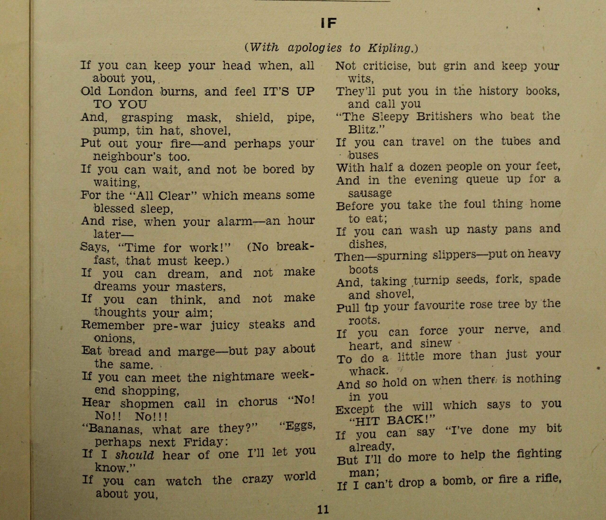
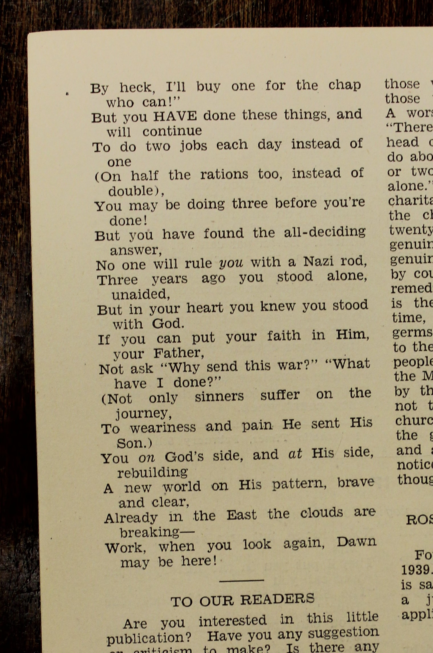
This year, 2023, is the 100th anniversary of my parish, Our Lady of Lourdes, in north London. As part of the celebrations the parish priest, Fr David, asked me to edit a commemorative book about the parish and its history. So last week I made an appointment to visit the archives of the Diocese of Westminster, where I was given the box containing the parish archives.
Among the papers I found a copy of a previous commemorative booklet, one that had been produced to mark the 20th anniversary of the parish’s founding. Only, this was in 1943, in the middle of World War II. Among the other items in the booklet was a poem, modelled on Rudyard Kipling’s If, telling what life was like in a north London suburban parish that had seen much bombing due to the main east coast railway line running through the parish. The poem was written by the parish priest, Fr Joseph Sunn, who founded the parish in 1923. It is one of the most vivid portraits of what life was like for the people on the home front that I have ever read and finding it in the archive was an inexpressible delight.
For the first time in 80 years, you can read it too. Below are pictures of the text, and below that my transcription of the poem.
IF (with apologies to Kipling)
Fr Joseph Sunn
If you can keep your head when, all about you, Old London burns, and feel IT’S UP TO YOU And, grasping mask, shield, pipe, pump, tin hat, shovel, Put out your fire – and perhaps your neighbours too. If you can wait, and not be bored by waiting, For the “All Clear” which means some blessed sleep, And rise, when your alarm – an hour later – Says, “Time for work!” (No breakfast, that must keep.) If you can dream, and not make dreams your masters, If you can think, and not make thoughts your aim; Remember pre-war juicy steaks and onions, Eat bread and marge – but pay about the same. If you can meet the nightmare weekend shopping, Hear shopmen call in chorus, “No! No!! No!!! “Bananas, what are they?” “Eggs, perhaps next Friday: If I should hear of one I’ll let you know.” If you can watch the crazy world about you, Not criticise, but grin and keep your wits, They’ll put you in the history books, and call you, “The Sleepy Britishers who beat the Blitz.” If you can travel on the tubes and buses With half a dozen people on your feet, And in the evening queue up for a sausage Before you take the foul thing home to eat; If you can wash up nasty pans and dishes, Then – spurning slippers – put on heavy boots And, taking turnip seeds, fork, spade and shovel, Pull up your favourite rose tree by the roots. If you can force your nerve, and heart, and sinew To do a little more than just your whack. And so hold on when there is nothing in you Except the will which says to you, “HIT BACK!” If you can say “I’ve done my bit already, But I’ll do more to help the fighting man; If I can’t drop a bomb, or fire a rifle, By heck, I’ll buy one for the chap who can!” But you HAVE done these things, and will continue To do two jobs each day instead of one (On half the rations too, instead of double), You may be doing three before you’re done! But you have found the all-deciding answer, No one will rule you with a Nazi rod, Three years ago you stood alone, unaided, But in your heart you knew you stood with God. If you can put your faith in Him, your Father, Not ask “Why send this war?” “What have I done?” (Not only sinners suffer on the journey, To weariness and pain He sent His Son.) You on God’s side, and at His side, rebuilding A new world on His pattern, brave and clear, Already in the East the clouds are breaking – Work, when you look again, Dawn may be here!
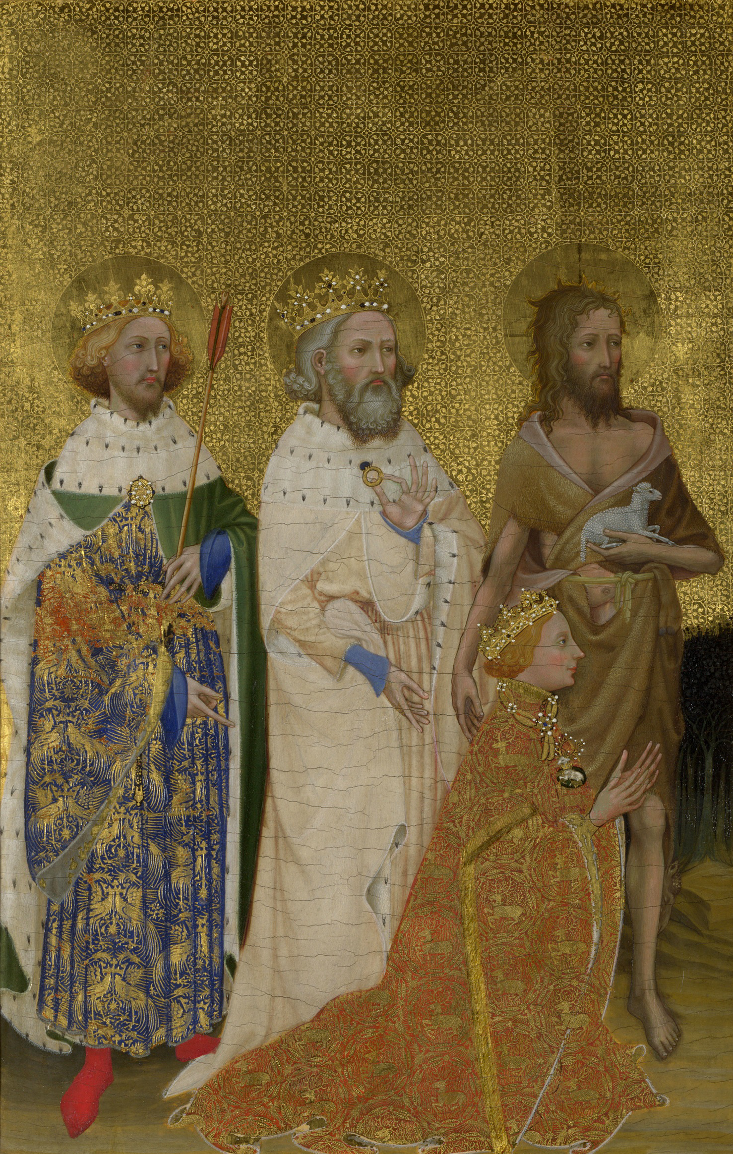
Edward the Confessor as depicted in the centre of the Wilton Diptych.
William, Duke of Normandy, knew Edward, future king of England, as a boy. This is because, when William was born, Edward was living in exile with his mother’s relatives in Normandy. Cnut had conquered England and Edward had fled with his mother, Emma, He had no expectation of ever becoming king. But when, via a series of unexpected marriages and early deaths, Edward came to the throne in 1042, William was 14 and quite old enough to be engaged by the politics that brought Edward the crown.
As king of England, Edward retained close links with the court where he had grown up. As king, Edward had had to engage with the powerful Earl Godwin and his family, marrying Godwin’s daughter, Edith, and raising Godwin’s son Harold to an earldom. But Edward apparently chafed at this dependence and in 1051 Edward moved against the family, forcing Godwin and his sons into exile and sending Edith to a convent. However, Godwin and his sons returned the following year with an army and, to prevent civil war, Edward had to reinstate them and take Edith back as his wife and queen.
However, during the year when Edward was free of the Godwins, one version of the Anglo-Saxon Chronicle recorded a visit from across the Channel. Around October or November of 1051, William with his retinue visited Edward. Remembering his debt to the Norman court and his dislike of Earl Godwin and his family, it’s possible that Edward promised the throne to William should he remain childless.
William returned to Normandy convinced that, so long as Edward and Edith did not unexpectedly produce an heir, then he would be king of England.
Of course, what William did not know was that Edward did not have the authority to promise the crown to William. There were no fixed laws of succession but rather a series of traditions, starting with blood relation to the previous king but also involving the promise of the previous king and the assent of the English magnates.
The situation was slowly being set for the disaster that was to befall the English nobility.
The Battle of Hastings brought the world of the old Anglo-Saxon nobility to a bloody end. Twenty years after the battle, when the Domesday Book, William’s inventory of the country was completed, Englishmen owned just five per cent of the country. William of Malmesbury (c.1095 – c.1043), an Anglo-Norman monk and chronicler, wrote that “England has become the dwelling place of foreigners and a playground for lords of alien blood. No Englishman today is an earl, a bishop or an abbot.”
The Anglo-Saxon nobles who survived the invasion and William’s brutal supression of the rebellions of the next decade went abroad. Exiled Englishmen fetched up all over the old North Sea world. But some went further, all the way to Byzantium. With so many battle-trained exiles looking for employment, the Emperor’s Varangian Guard, which had previously been manned by Scandinavians, became a largely English unit.
They left behind an England where it seemed that the language might change as completely as land ownership. The new Norman kings spoke French and Latin and made little attempt to learn the language of their subjects. However, Henry I, the third in the line of Norman kings, began a revival in English and English customs that might have led to early reconciliation if it was not for his lack of a male heir. Henry designated his daughter, Matilda, as ruler but Stephen, William’s grandson, wanted the crown for himself. The ensuing 20-year civil war caused such destruction that it was called the Anarchy and, the Chronicle lamented, “Christ and his saints slept.”
But at the more local level, contacts between the 8,000-odd Norman settlers and the native English slowly improved. Intermarriage had become common by the early 12th century. While there were no English abbots, Englishmen served as priors in monasteries and monks worked to improve relations between the two peoples. And when the Anarchy ended and Henry II ascended the throne at the end of 1154, things had changed. A century after Hastings, English had become again the national language, although the Old English names were largely lost. The English were now a race of Roberts and Johns and Williams, rather than Æthelwins and Œthelwalds and Oswalds.
By 1170, Richard fitz Nigel could write, “In the present day, the races have become so fused that it can scarcely be discerned who is English and who is Norman.” The conquerors had, in the end, been assimilated.