This Generation’s Challenge

Every generation faces a crisis.

Our grandparents had to deal with World War II, which they won through courage and sacrifice.

Our parents had to face the Cold War, which they won by patience and perseverance.

Now we face the coronavirus, which we can defeat by sitting in front of the telly.

We can do this.

Adventures in Bookland: The History of the Kings of Britain by Geoffrey of Monmouth


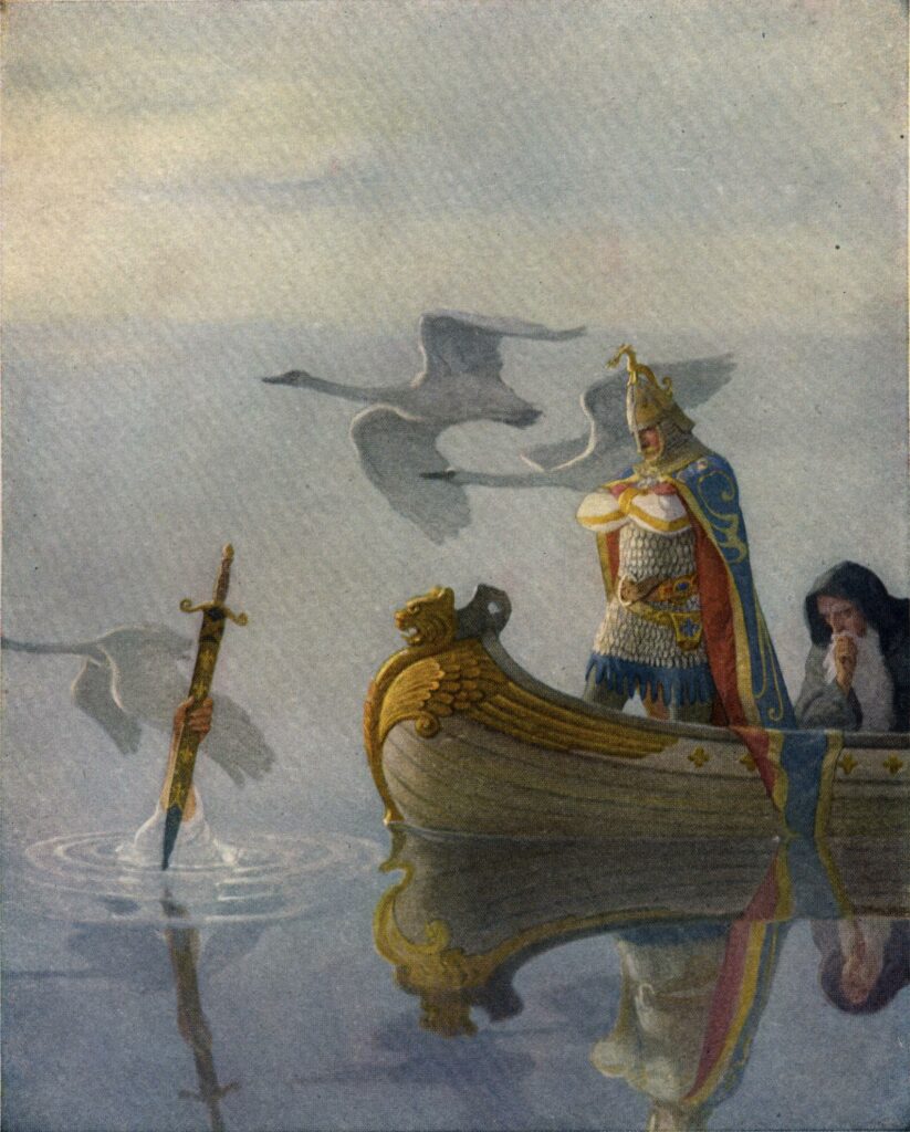
Geoffrey of Monmouth, a Welsh cleric (although possibly his family came from Brittany), wrote his Historia Regum Britanniae around 1135 and, almost immediately, it was dismissed by other chroniclers and historians as almost complete nonsense. It tells the story of the Kings of Britain, that is the native kings before the arrival of the Anglo-Saxons, finding the origins of the Britons in the fall of Troy and another princely Trojan refugee, Brutus in this instance. Virgil, the poet of imperial Rome, had of course mined a similar seam of history in his Aeneid, linking the origins of Rome to Prince Aeneas. So by linking the history of the Britons to that of Troy, Geoffrey was also implicitly making them cousins to Rome. It was a bold stroke for a marginalised people. He then went on to tell the stories of the kings of ancient Britain: in these pages you will find King Lear and his daughters, Old King Cole and, of course, Arthur. Geoffrey expands the few nuggets about Arthur that had appeared in previous works hugely, adding in the key figure of Merlin to the mix.

Despite the book being treated as nothing buy fantasy by historians such as William of Newburgh, it quickly became famous and widely read, introducing these kings into the folklore and folk memory of Britain. Having read the History of the Kings of Britain I can now see why. It is simply such great fun to read. Geoffrey breezes through the centuries, sometimes spending just a sentence on a king, at other times opening up the story to a chapter length or more. It’s a great piece of storytelling, dressed up as history.


Adventures in Bookland: Ancestral Journeys by Jean Manco

Few books manage to be simultaneously so fascinating and so eye glazing. The tale of the movements of the successive waves of people that have made and remade Europe is fascinating, and the new science of DNA analysis that allows for the extraction of ancient DNA and its comparison to the modern inhabitants of a country is a salutary corrective to the strong tendency in archaeology and historical studies in the latter half of the 20th century to deny all movements of people in favour of cultural overlay and small groups of elite warriors while the peasants remain, lumpen and unmoved on the land (although these lumpen peasants do, by this view, display a remarkable ability to change languages and cultures at the arrival of a new bunch of guys waving swords). Since all the contemporary accounts of the age of migration talk about the movements of peoples, it’s good to accord the contemporary witnesses some credit for telling what they saw. However, on the eye glazing front, I defy anyone to get through a few pages of Y-DNA haplogroup R1a1a and the like without their head drooping.


Adventures in Bookland: Athelstan by Tom Holland

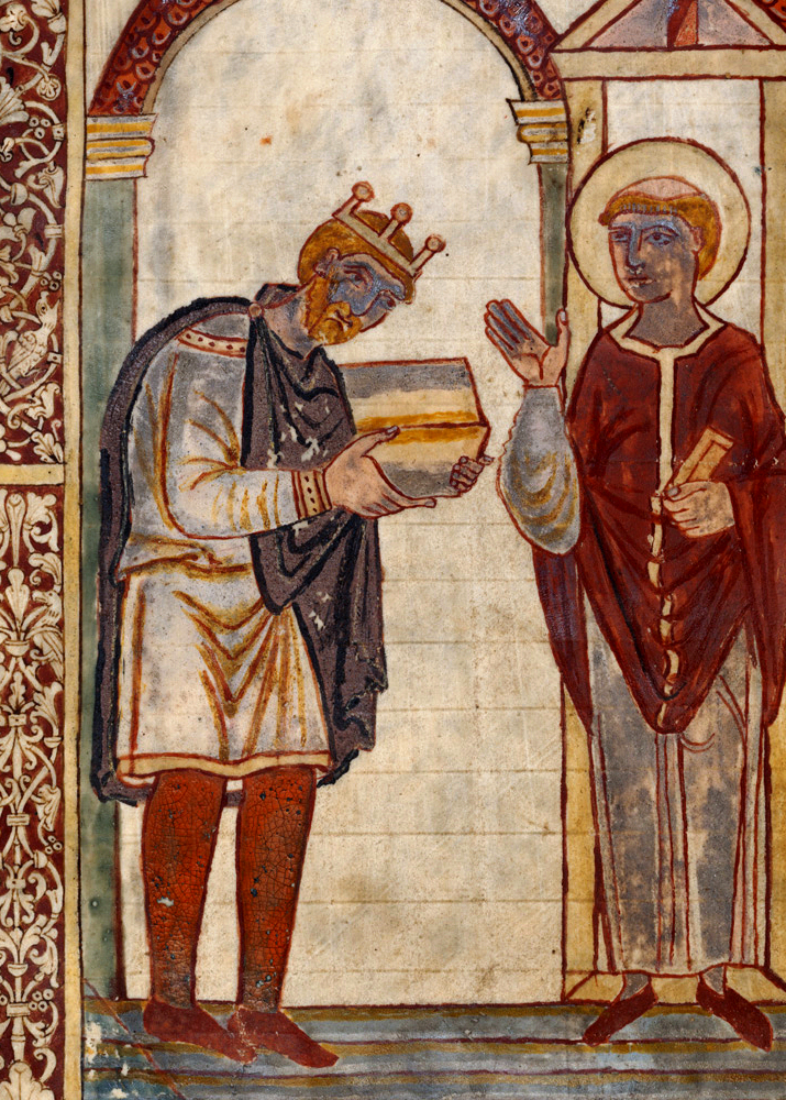
No king in England’s history has been more unjustly forgotten than Æthelstan. This forgetting is all the more poignant in that Æthelstan can reasonably claim to be the first king of England. Not many other nations would flush their founder down the memory hole: Washington adorns dollar bills, every Roman could tell you the story of Romulus and Remus, and Napoleon, the founder of modern France, has had more books written about him than any other human being in history apart from Jesus Christ. But on Æthelstan, almost nothing.

Hopefully, Tom Holland’s marvellous little biography will go some way towards rescuing Æthelstan from his obscurity. With all the excitement that the story deserves, Holland whisks the reader back to 10th century Britain, when the Northmen did not merely launch picturesque, TV mini-series worthy raids, but embarked on expeditions of conquest; this was a country that had suffered two generations of depredations, when anyone living near sea or navigable river went to sleep with the fear that they might wake to find their homes being ransacked and fired, and their children being carried off into slavery. For amid the revision of Vikings as romantic heroes, little attention has been paid to the fact that their most valuable booty was human: men, women and children hauled off to be sold in the slave markets at Dublin, the Viking town that stood at the nexus of the slave routes that delivered captured people to miserable new lives from which they would never return.

Æthelstan, following in the footsteps of his grandfather, Alfred, and his father, Edward the Elder, was a man committed to defending and instilling civilisation in the face of the barbarians. For, make no mistake, for all their accomplishments as explorers and traders, the Vikings were barbarians. Three generations of the most remarkable family in English royal history had made it their lives’ work to first defend and then to reconquer England, and Æthelstan stood at the summit and consummation of this extraordinary familial endeavour. Then, when all seemed accomplished, all was thrown into doubt when the kings of the Vikings, of the Scots and of Strathclyde united against him. The ensuing battle, Brunanburgh, was ‘the battle’ for a hundred years, the battle that ensured that England would be England, and not dismembered. Read Holland’s book and marvel at the scale of Æthelstan’s accomplishments and how much we have to be grateful  to him for.


See Like An Archaeologist

Paul Gething, director of the Bamburgh Research Project

“Medieval tile. Medieval pottery. Another piece of pottery. More tile. Animal bone.” Paul Gething, archaeologist, picked through his finds.

I had, literally, been walking on history, oblivious to its presence beneath my boots.

We were standing on a path down from the great crag of rock upon which Bamburgh Castle in Northumberland squats. Paul had just told me that most people are oblivious to what lies beneath their feet and I had challenged him to prove it. Within ten yards he’d found these remains.

Paul Gething is co-director of the Bamburgh Research Project (BRP), a multi-disciplinary archaeological dig investigating the history in and around Bamburgh. We’ve known each other for many years, but this was the first time I’d asked him to explain how he sees the world through the eyes of his discipline. I looked at his finds. To my eyes, they still looked like battered old stones.

“People have been here since Neolithic times, so it’s not hard to find things,” said Paul. “People drop litter now, and they threw away their rubbish then; we’ve not fundamentally changed over the centuries.”

In Northumberland, this continuity is visceral, tangible. The ramparts of Bamburgh Castle loomed above us. The fortress, capital of the lost kingdom of Northumbria, sits on top of a great outcrop of basalt, a part of the Great Whin Sill rock formation that stretches from the North Pennines to Northumberland. Out to sea, the Farne Islands, where St Cuthbert withdrew from the world and befriended the local eider ducks, are made of the same hard rock. The islands glittered darkly against an unexpectedly blue sky, while a few miles to the north, Holy Island (Lindisfarne) had, until the tide turned, rejoined the mainland.

Paul looked out to sea. “Ten thousand years ago, that was land. I think hunters camped here, watching the herds trailing past on their way to their feeding grounds.”We’d started the day by inspecting the trenches the BRP has dug in the grounds of the castle. Teams of archaeologists on hands and knees were carefully scraping away the earth with trowels, noting and tagging every find. For the really delicate work, they employed toothbrushes. The archaeologists here come in all ages, from pensioner to schoolchild, for one of the key objectives of the Bamburgh Research Project is to make archaeology accessible: anyone, from members of the public to Indiana Jones, can dig after being taught the necessary skills. The site is open in the summer and people can sign up for anywhere between one day and two weeks.

Paul Gething and Graeme Young, directors of the Bamburgh Research Project, inspecting finds in one of the trenches in Bamburgh Castle

Leaving the archaeologists in the trenches, we set off along a section of the St Oswald’s Way long distance path. It seemed to me that Bamburgh Castle, once the capital of the kingdom of Northumbria, was an obvious place to do archaeology, but Paul bet me that archaeology could illuminate any walk.

“Before setting out, look at the map. The names are clues to the past. For instance, -burgh is the Anglo-Saxon word for ‘fort’, and -by is Old Norse for a village, so that tells you who settled there and named the features of the landscape. Then look at aerial photographs, or satellite images – Google makes this easy – since things often show up more clearly from above.”

Heading down into the marram grass covered dunes, Paul told me how an old Ordnance Survey map had given them a vital clue when the BRP first started digging here. There were written references to a burial ground in the vicinity of Bamburgh Castle, but they had no idea where to search for it. But then they looked at the very first Ordnance Survey map of the area and there, to the south, were the neatly printed words ‘Danish burial ground’. We made our way through a small wood (“Just regrowth, only a couple of hundred years old”), the air thick with the buzzing of heat-drugged insects, until we came to the burial ground. Paul said they’d found over 100 skeletons here, dating from the seventh and eighth centuries. The remains indicated the people buried here were from the nobility – “They were all well fed” – and some had come from as far away as Western Scotland and Norway, only to meet their end in the service of the kings of Northumbria.

Heading inland, Paul stopped at a pasture. The cows looked up placidly before returning to cropping the grass.

“Ridge and furrow,” Paul said, indicating the undulations that ran across the field. “Or rig and frig in archaeological slang. Medieval, judging by the distance between the ridges. Roman fields have narrower gaps.” Parallel lines, like the ripples that form on beaches as the tide goes out, marked the field in straight lines. In medieval times common land was ploughed or dug in long parallel strips. The soil from the furrow was piled on to the ridge, creating two different microclimates for crops. In a dry season, the seeds down in the water-collecting furrow would be assured enough moisture for growth, but if the year was wet, the crops in the freely-draining ridge would flourish. Thus medieval peasants hedged their bets and their labour to ensure a crop. Where the field has been turned over to pasture rather than cross ploughed, the centuries-old pattern of cultivation can still be clearly visible.

“The rule of thumb is the wider the gap, the nearer it is to our own time. Roman fields have a three-metre gap between the ridges, medieval ones from five to eight metres.”

Paul was winning the argument before we’d gone a mile. I asked him if there were any other archaeological landscape features that an amateur could spot and he pointed to a roughly circular patch of nettles sitting alone in the corner of a nearby field. Nettles love phosphorus, and the excrement of cattle and sheep is rich in the element. Those solitary patches I’d often seen in the past usually marked the site of a medieval sheep or cow pen. Although the enclosure had disappeared, the plants lived on on the bounty left by the long-dead animals.

“My family are always moaning that whenever we go anywhere, I’m always saying that’s rig and frig, or there must have been Roman villa in the vicinity, but I can’t help it. It’s just part of the way I automatically process a landscape. For instance, near where I live in York, a Second World War airfield is reverting to scrub. It’s an archaeological test bed. There’s rig and frig fields, crab apples that aren’t native to Britain – my guess is that pilots flew over from America, ate the apple they’d bought there and then threw away the core – and miles of underground tunnels that I’ll bet future archaeologists will take to be sewers, but are actually communication ducts.”

BRP archaeologists hard at work

A couple of miles inland, with the Cheviots looming in the distance, we arrived at another BRP dig. This one cut through the grass, topsoil and subsoil to reveal the limits of a prehistoric lake. One of the archaeologists there told me that in Mesolithic times, that is between 10,000 and 5,000 years ago, where we were standing was a large figure-eight-shaped lake, and we were standing at the pinch point of the lake. It was the obvious place for a settlement, but our distant ancestors were proving elusive. The archaeologists had only uncovered the remains of a millennia-old ditch so far.

Walking back to the castle, Paul showed me an arrowhead he’d found at the edge of a field. It was an exquisitely worked, barbed and tanged late Neolithic flint. But what could this solitary find tell us?

“I’m firmly convinced that the key skill archaeologists have to learn is how not to focus on what is in front of them. Five thousand years ago, skilled artisan could produce half a dozen arrowheads like this every hour. They were as disposable as Bic razors. The shafts, on the other hand, were a different matter. Finding and preparing a truly straight length of wood was difficult. Once that was done, the shaft had to be fletched too. For Neolithic man, the valuable part of an arrow was not the arrowhead but the shaft. What would happen, though, if an animal wasn’t killed outright but fled, taking your valuable arrow with it? So they made their arrows in such a way that the arrowhead would break off easily, leaving the shaft to be retrieved.”

Looking at the killing instrument, I was transported back in time to a world of woods and marshes, and a hunter drawing his bow on a deer and loosing his arrow, but the beast, startled, leapt away, the arrow protruding from its haunch. The shaft broke off as the deer careered through the trees and the pursuing hunter spotted the bright feathers of its fletch lying in the moss. The deer escaped, only to die a few days later when the wound became infected. Scavengers cleared the remains, but the indigestible flint of the arrowhead fell to the earth, and was covered over, only to be uncovered centuries later when a sweating medieval peasant piled the spoil from the furrow on to the adjacent ridge. There it remained, alternately exposed and hidden, until a passing archaeologist saw it glittering on the ground and grasped its significance.

Paul had won the bet.


Adventures in Bookland: The Journey Through Wales by Gerald of Wales


It’s not often you can peer back eight hundred years and see the world as a man living then saw it in all its wonder, difficulties and humour. But that is what you get reading Gerald’s account of his trip through Wales, accompanying the Archbishop of Canterbury as he preached Crusade to the locals. Gerald himself was three quarters Norman and one quarter Welsh, through his extraordinary grandmother, Nest, who went through husbands and lovers faster than a Norman went through Saxon landholders. Gerald’s account of his travels is full of travellers’ tales, of varying degrees of likelihood but of unvaryingly great interest, and the minutiae of 12th century travel, from the dangers of quicksand to the wit of monks bemoaning unfit lodgings. It’s a wonderful insight into a world and a man long past, but made present, through the extraordinary magic of the written word, to every generation anew. As fresh and invigorating as the morning breeze on the Pembrokeshire coast.

In Search of England’s Lost Wildernesses

This article first appeared in The Great Outdoors magazine. I like it and, to save it from complete obscurity, here it is for my handful of faithful blog readers. I hope you enjoy it! I’ve included some of the photos I took for the article, but my camera failed for the first walk, to the Thames marshes near Fobbing, so I’ve included a couple of Wikipedia images in its place. As a writer who takes photos for articles, my only advice is to get there early to catch the dawn light and, possible in this digital age, take hundreds of shots. Some of them will turn out all right!

In search of England’s lost wildernesses

Confession time. I love mountains, the wild high places this magazine is dedicated to, but it’s the flatlands – marshes, fens, plains, steppes – that fascinate me, exerting a sort of appalled, rubbernecking attraction. There’s something about the way I can walk for hours and then stop and look around and realise that I haven’t got anywhere; how the sun pins the walker to the ground like a sadistic lepidopterist; the way the world itself seems to roll beneath your feet as if each stride is turning the globe.

I would have chalked this all up to personal peculiarity if it had not been for a series of discoveries while writing and researching my books. It turns out that, for almost all our history, the true wildernesses of England, the places people whispered of in fire-lit tales as the refuge of monsters and the haunt of bandits, were not mountains and moors, but marshes and meres. When Alfred the Great fled Guthrum’s surprise attack on Twelfth Night, he made his way through the winter landscape to the ‘fen-fastnesses’ of Athelney, the Isle of Princes, an island surrounded by the shifting waterways of the Somerset Levels. After William the Bastard had cut down Harold at Hastings and harrowed the north, the last defiance against the Normans came out of Fenland. Smugglers and bandits, radicals and revolutionaries have all emerged from or taken refuge in England’s shifting, uncertain wildernesses, disappearing into legend among the rushes and reeds. Today, those seeking escape from civilisation and its discontents head north and west, to where the geology of Britain has largely confined our hills and mountains. But, once, wildness was wet, not high.

So, I set out to explore what remains of England’s lost wildernesses. But, first, I had to find them.

I’m a Londoner: child of immigrants, born and raised in the Great Wen. The city is a creation of the river, the ‘strong brown god … unhonoured, unpropitiated … but waiting, watching, and waiting’, and the Thames marshes were the first lost wilderness I went in search of. The Romans built their bridge at the first bridgeable point of the Thames, joining the gravel pile of Ludgate Hill to the salt marshings of Southwark. Downriver, the river carved brown channels through a flood landscape, until generations of hydro engineers forced it, sullenly, into channels. The gateway to Empire, the Thames became the busiest, richest thoroughfare on earth, a honeypot of sail and steam, with settlements perched upon high, dry ground, all the way to the sea.

The marshes of the Thames

By the village of Fobbing, near the candy-coloured delights of Canvey Island, the land steeps down to a flat, ridged plain, scored with creeks and channels; a five-thousand-acre remnant of the great Thames marshes that walked along the river to the sea. Arriving at dawn just after the longest day of the year, I was greeted with a sight that was slightly less apocalyptic than I’d hoped for. Yes, the sun in its rising stained the river a pleasing shade of crimson, but where were the columns of fire? Last time I’d been this way, the oil refineries by the river were sending up great gouts of flame from ranks of flare stacks, as if greeting the sun in kind. But today, the refineries were cold, lifeless. I learned later that they had gone into receivership; the last shut down in 2013 – apparently even oil mega corporations can go belly up.

Fifteen minutes later I was thoroughly lost. This, I decided, staring at a hugely unhelpful OS map, was ridiculous. I was only just outside the M25, smack in the middle of the most densely populated area of the most densely populated country in Europe (England having overtaken the Low Countries), and I was lost. But lost I was, and as morning mist rose up to cover my legs, and drown any appreciable landmarks in shifting grey, I caught a first, halting sense of the shifting, subtle nature of these places, which are neither land nor water, but phase from one state to the other; as shapes swirled thickly in the mist, I began to catch some of the fear that stalks the accounts of fens and marshes in English tales and legends. But then the shapes resolved into cattle, as surprised to see me as I was to see them, and the rising sun began to burn off the mist.

By Glyn Baker, CC BY-SA 2.0, https://commons.wikimedia.org/w/index.php?curid=9150043

After so long walking on level ground, the climb back up to Fobbing proved surprisingly difficult for muscles trained into the horizontal. In the village, outside the White Lion pub, I saw a sign commemorating the villagers who had risen in revolt against the imposition of a swingeing poll tax – but this revolt took place in the 1380s, not the 1980s. The people of Fobbing lit the match that set off the Peasants’ Revolt; John Ball, the hedge priest whose sermons (‘when Adam delved and Eve span, who was then the gentleman?’) on the injustices of the feudal system provided the spiritual justification for the revolt lived in Norfolk and Essex before moving to Kent; John Wrawe raised the men of Essex and stirred revolution in Cambridgeshire.

By ClemRutter – Own work, CC BY 2.5, https://commons.wikimedia.org/w/index.php?curid=2104727

As I walked the flatlands and marshlands of England, I found myself also following a trail of religious and political radicalism – it almost seemed that the flatter the landscape the more revolutionary the ideas it spawned.

The island of the marshes

There are few areas flatter than Lincolnshire. This was once the marsh kingdom of Lindsey, one of the small realms that grew up in the post-Roman splintering of Britain, a domain created by its geography for the great fenlands of Cambridgeshire formed its southern limit, and the Humber estuary its northern edge, while the rivers Witham and Trent all but cut it off from the country to the west. Lindsey, ‘the island of Lincoln’, has the cathedral as its peak, but other islands rose from the surrounding seas of marsh and reed, notably the Isle of Axholme. That was where I went next in my search for England’s lost wildernesses.

Trent, the name of one of the two great rivers that drain into the Humber Estuary, comes from the Brythonic word ‘Trisanton’, which means ‘trespasser’. A better description for the river could scarce be found, for it is a wilful, unpredictable water, forever flooding the flatlands around its mouth. The Isle of Axholme was an isolated area of raised ground above the surrounding marshland, and the site of the first great battle over the use and reclamation of fenland. In 1626, King Charles I sold Hatfield Chase, a huge area of peat bog just west of the Isle of Axholme, to a Dutch drainage engineer named Cornelius Vermuyden, who would get to keep for himself one third of the drained land. Only, the king had no authority to sign over the rights of common grazing, which local people depended upon. For where outsiders looked upon Hatfield Chase and saw it as ‘evil in winter, grievous in summer and never good’, the people who made their living around and upon the marshlands understood them well, exploiting them for lush pasture in high summer when other fields were bare, fishing and fowling, harvesting hemp for sails and rope, and cutting peat. But the marshmen were viewed with no less suspicion than their land: ‘Fenmen, disgusting representations of ignorance and indecency!’ They may not have been educated, but the people of Axholme could work out what the drainage ditches Vermuyden was digging through Hatfield Chase meant and they ‘came unto the workmen and beat and terrified them, threatening to kill them, if they would not leave their work’. The Battle for the Bogs had begun.

It continued for the best part of the next three centuries, the rich and powerful gradually nibbling away at the marshland and taking it under their control, until the original 880 square miles of marsh in the Humberhead Levels was reduced to the peat bogs of Thorne Waste and Hatfield Moor, which Fisons continued to strip mine. It was only in 2002 that the remaining peat bogs were saved.

Arriving at dawn, and pausing to take photos, a cloud of insects descended and I was immediately reminded that the first, and greatest, defender of the marsh was the mosquito and the diseases it carried. Ague – malaria – the sweating sickness of marsh and fen had done much to create the miasma of fear that surrounded England’s wildernesses – for after all, a true wilderness must have the potential to kill the visitor.

‘Beware of adders.’ The signs, helpfully posted at intervals, showed there were other possibly lethal inhabitants of the Moor. Sadly, any snake sunning itself in the early morning light heard me long before I saw it, and slid quietly away, but the birds were not nearly so bashful, serenading me throughout in the most full-throated manner I’ve heard outside a rainforest. The patchwork of ponds, bogs, lakes, woods, scrub and stripped clear peat make for as varied a series of habitats as can be found in Britain today.

It was a dislocating place, caught between different places and times, and I, more suspended than most, was held in remembrance of King Edwin of Northumbria, High King of Britain, who fought his final battle here, amid the meres. Thinking of the men slain thirteen hundred years before, I emerged on to the stripped slabs of the Moor, where the industrial scrapers of Fisons and others pared the peat from the land, leaving a landscape that’s as near to the Western Front as anything I’ve seen. Walking out into the wastes, water lying in sheet silver either side of the ridges, I was in as lonely a place as there is in England.

Perhaps the inmates of HMP Lindholme, the double wire, razor-topped fences of which run alongside the western edge of Hatfield Moor, take some solace in the grey green banks of alder and willow that wave beyond the prison’s confines. Walking the perimeter fence is a chastening experience, the metallic clangs from the prison works interpsersing with the occasional siren. But a turn into a glimpsed opening, and I was bathed in green, leaf-filtered light, the skeletal finger of a bog-drowned tree pointing from water to sky. Leaving the moor – in Old English, the word derives from ‘morass’, again showing how our wilderness derives from the wet – I returned to the Isle of Axholme and found that here too, the flatlands had produced a radical re-evaluation of society; for Epworth, a village of the Isle, was the birthplace and early home to John and Charles Wesley, the founders of Methodism. Again, the flatlands were the cradle of radicalism. What would the Fens, greatest of them all, produce?

The Great Level

Driven from Hatfield Chase, bankrupted and imprisoned, Cornelius Vermuyden bounced back. The Fens were the great prize for the land reclaimers, and Vermuyden, with his Dutch expertise, was their chosen champion. But the locals fought back, destroying sluices and breaking dams. Insurrection was in the air, and the commoners found a champion in a local farmer, a ‘Mr Cromwll of Ely’. This farmer ensured that their complaints against the commandeering of the commons was included in the Grand Remonstrance presented to King Charles I in 1641.

But in a betrayal that seems as great as the remonstrance, once the king was beheaded and the farmer had become Lord Protector, Cromwell instigated the draining of the Great Level, engaging the men of his own New Model Army to guard the work parties. Battle continued through the next two centuries, but it was a one-way process. Charles Kingsley, writing in the 19th century, remembered how ‘dark-green alders, and pale-green reeds, stretched for miles round the broad lagoon … high overhead hung, motionless, hawk beyond hawk, buzzard beyond buzzard, kite beyond kite, as far as eye could see … They are all gone now.’

The largest of all England’s wildernesses, the Great Level, which brought down a king and defied a conqueror, was finally bisected and dissected, its life-giving waters drained, in the 19th and 20th centuries. ‘Ah, well, at least … children will live and not die. For it was a hard place to live in, the old Fen.’

It’s not quite all gone. Wicken Fen is the oldest site in the care of the National Trust, some 900 acres of fen, part of which has never been drained. The Trust plans to extend this to 10,000 acres, stretching as far as Cambridge, by the end of the century. I set off to walk from Wicken to the Isle of Ely, Cromwell’s home, following the River Great Ouse. Wicken Fen is a bird watchers’ – and song listeners’ – delight; it resounded with liquid chimmers and churrs. The channels that bisect it would have been easy for the shallow-drafted vessels of the Angles, the Saxons and the Vikings to navigate, enabling them to strike inland, far from the sea.

The river ran north, between over-engineered banks, towards the distant, looming tower of Ely Cathedral. I’d been walking for a while before I realised that the Ouse ran at a higher level than the surrounding fields of carrots and cabbages; it flows between raised embankments for now but should the levee break, the flood would be catastrophic; for the peat of the levels, once drained, has shrunk, lowering the ground surface below river level, below sea level. It was with fantasies of flood running through my imagination that I arrived in Ely and plodded upwards to the exquisite cathedral – our medieval forbears knew better than us how to create an architecture that enhanced a landscape. Cromwell’s old house is now, ignominiously, a tourist office and small museum.

Returning, as twilight fell, along an almost enclosed green lane, a hunting barn owl swooping below the branches nearly flew into me and two playing hares ground to an abrupt halt before making off into the fields.

The Fen was dark when I returned. I, as do we all, enjoy the benefits of modern civilisation but listening to the creak of willow I dreamed of flood, and the return of the waters to the Great Level. In Beowulf, the great Anglo-Saxon epic, the monster Grendel stalks Hrothgar’s hall from his lair in the fens. In England’s national poem, the monster comes from the marsh. I listened, but all I heard was silence.

The writer, George Monbiot, has called for the rewilding of Britain, but he has largely confined this to the hills and jeremiads against sheep, to places far from where we live today. How much more worthwhile would it be to reclaim England’s true lost wildernesses, that mostly lie around and about our centres of population, that we might, once again, have at our doorsteps the great, stinking, shifting levels.

What would the world be, once bereft
Of wet and of wilderness? Let them be left,
O let them be left, wildness and wet;
Long live the weeds and the wilderness yet.


Adventures in Bookland: In the Land of Giants by Max Adams

There’s a new genre of writing that is currently struggling towards birth – and a proper name. It’s a combination of memoir, history and travel writing – let’s call it the autogeschicte – and, as I know only too well, it’s not easy to do well. I tried to write something along these lines in my London: A Spiritual History, and discovered how difficult it is to hold these disparate elements, that are all too often pulling in different directions, together. Max Adams tries to get under the surface of the Dark Ages by walking the landscapes of its history, mixing memoir with the daily discomforts and joys of walking in our wet climate, all leavened with bits of history along the way. I loved his The King in the North, so I had high hopes for this book, but it proved slightly disappointing. The travel elements were reasonable, but one wet walk ends up resembling another; the memoir was all very well but not sufficiently remarkable to engage much interest; and the history seemed superfluous. In the end, this seemed like a book that helped justify some walks Adams had long wanted to make (together with boat and motorcycle trips) rather than a work that existed in its own right.

Adventures in Bookland: God’s Battalions by Rodney Stark

So, were the Crusades an early exercise in Western imperialism, a pilgrimage of greed and violence visited upon the peaceful and civilised peoples of the Middle East, as the modern understanding of them suggests? This useful revisionist overview of the most recent scholarship argues strongly that they were not. Rodney Stark’s main targets are the popular historians and the film makers and writers who have filtered this view of the Crusades into everyday consciousness and done so so successfully that that great medieval hero, Richard the Lion Heart, is now regularly traduced as a psychopathic killer and, in the word’s of one popular historian, ‘the worst king in England’s history’.

As anyone giving the matter a little thought would surely recognise, the current view is as partial as the high Victorian view of the Crusaders as exemplars of Christian martial piety. The truth is more mixed, and more interesting, than that – but the Victorians were closer than the moderns. Most notably, the Crusades were not imperialist adventures, nor land grabs by the landless by blows, the younger sons of noble families, but rather serious enterprises by a network of interconnected families who committed their money and their blood to the retaking and the defence of the Holy Land. Careful work by historians on wills, charters and the other deep sources of history confirm this: the Crusaders were, indeed, what they said they were: pilgrims for Christ, sacrificing wealth and, often, health and life, for the sake of reclaiming and protecting the holy places in the Holy Land. As to the reputation for chivalry of their Muslim enemies, it is clear that they were no more chivalrous than the Crusaders, and just as frequently they waded through blood and bodies.

In the end, the Crusades failed because the European nations that had supported them became unwilling to fund the vast expenditure, in money and men, required to maintain Outremer. But reading this fascinating account of the whole enterprise, one can only be impressed, sometimes appalled, but never less than respectful of the men and women who committed their lives and resources to the enterprise. A crusade is something we should all commit ourselves to.